How long is the unpaved road to Geghak’ar in Syunik?
Geghak’ar is a high mountain peak at an elevation of 3,182m (10,439ft) above sea level in the Syunik province of southern Armenia. The track to the summit is one of the highest roads in Armenia, climbing through the high ridges of the Kajaran Municipality.
| Road facts: Geghak’ar Peak | |
|---|---|
| Location | Syunik, Armenia |
| Elevation Gain | 1,137 m |
| Length | 10.6 km (6.58 miles) |
| Average Gradient | 10.72% |
How is the road to Geghak’ar?
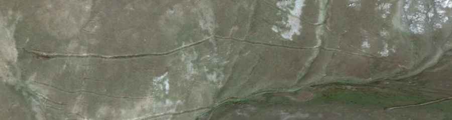
The climb starts in the village of Ajabaj and runs for 10.6 km of pure dirt and rock. In this short distance, you gain 1,137 meters of elevation. The average gradient is 10.72%, which means the engine will be working at its limit for most of the trip. The track is narrow and follows the edge of the mountain with no walls or guardrails. The surface is made of loose dirt and sharp stones that can easily puncture a tire or hit the underbody of the car.
How many hairpin turns are on the road to Geghak’ar?
The final part of the climb has 8 sharp hairpins to reach the 3,182m peak. These turns are very tight and have a loose surface, so you need a high-clearance 4x4 to keep traction without sliding toward the edge. In many of these switchbacks, the slope is much steeper than 10%, forcing the car to move slowly in low gears. There is no room to pass another vehicle, so one of you will have to reverse on the brink of the cliff if you meet someone coming down.
What are the weather hazards on the road to Geghak’ar?
The road is usually buried under snow and ice from October until June. In Syunik, the weather at 3,100 meters can turn in minutes; a summer storm will turn the dry dirt into deep mud ruts that trap the wheels. If it rains, the 10.72% gradient becomes a slippery trap where it is almost impossible to maintain grip. You must keep a constant eye on the temperature gauge, as the low-gear climb in thin air can make the radiator boil quickly.
What is the best way to descend from Geghak’ar?
You must use engine braking all the way down. If you rely only on the foot brake to manage the 1,137-meter drop, the pads will overheat and fail long before you reach Ajabaj. Check your tires and the 4WD system before you start, because if the car breaks down up here, you are completely on your own. There is no cell service and no one to call for help in this remote part of the Armenian mountains.