How long is the unpaved road to Ughtusar in Armenia?
Ughtusar is a high mountain peak at an elevation of 3,052m (10,013ft) above sea level in the Ararat Province of Armenia. The track to the summit is one of the highest roads in Armenia, crossing an ancient volcanic field of loose stones and high-altitude pastures.
| Road facts: Ughtusar Peak | |
|---|---|
| Location | Ararat Province, Armenia |
| Elevation | 3,052 m (10,013 ft) |
| Length | 24.9 km (15.5 miles) |
| Elevation Gain | 1,643 m |
How difficult is the road to Ughtusar?
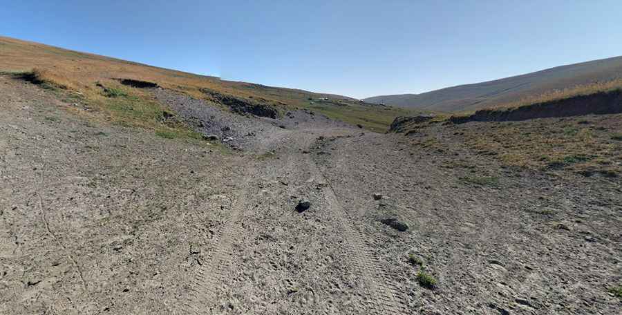
The climb starts in Gyughadzor and runs for 24.9 km. Over this distance, the road gains a massive 1,643 meters of elevation. The track is entirely unpaved and consists of a mix of loose dirt, volcanic rocks, and deep ruts carved by seasonal water runoff. A high-clearance 4x4 vehicle is strictly required; standard SUVs will bottom out on the jagged volcanic debris. The average gradient is 6.59%, but many ramps are much steeper, forcing the engine to work at high revs in low oxygen conditions.
What are the driving hazards on the Ughtusar track?
The main hazard is the lack of traction on the volcanic soil. When damp, the dirt turns into a slippery trap where tires quickly lose grip, especially on the steepest ramps. There are no guardrails or safety barriers on the ridge sections, leaving no margin for error if the vehicle slides. The track is often blocked by rockfalls or deep ruts left by heavy shepherd trucks. At 3,052 meters, your engine will lose significant power, making it difficult to restart the climb if you lose momentum on the loose stones.
Is the road to Ughtusar open year-round?
No. Snow remains on the upper slopes until late June, and the first winter drifts usually arrive in September. Sudden thunderstorms are frequent in mid-summer; these storms can turn the dry track into a mud bog in minutes. If you see clouds building over the peak, you must descend immediately to avoid being trapped by flash floods. There are no services, no fuel, and no mechanical help for the entire 24.9 km drive, so you must be completely self-sufficient.
What gear is needed for the Ughtusar ascent?
You must carry at least one full-size spare tire, as the volcanic rocks are sharp and can easily shred a sidewall. High-altitude driving in low gears will double your fuel consumption, so bring extra fuel for the 1,600-meter climb and descent. Use engine braking to manage your speed on the way down to avoid overheating the brakes. Mobile signal is non-existent in most of the volcanic basin, so traveling with recovery gear like a shovel and tow straps is the only way to ensure you don't stay stranded at 3,000 meters.
Pic: Transcaucasian Trail