What are the highest roads in Armenia?
Located in the Southern Caucasus region of Eurasia, Armenia is one of the oldest nations in the world. The country is a landlocked country in the Transcaucasia region, between the Black and Caspian Seas. Situated along the route of the Great Silk Road, Armenia has a rich and ancient culture. It’s bordered on the north and east by Georgia and Azerbaijan and on the south and west by Iran and Turkey. It’s a very mountainous country, almost totally covered by the Lesser (or Little) Caucasus Mountains, with fast flowing rivers and few forests but with many trees. The climate is highland continental: hot summers and cold winters.
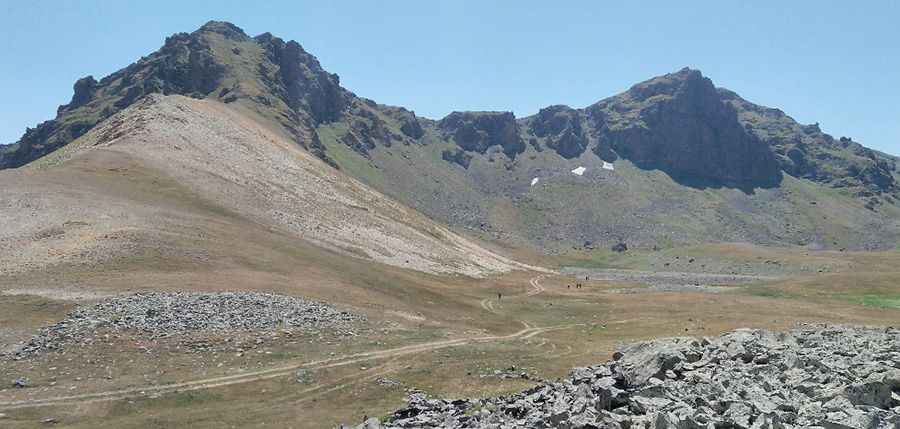
This highly elevated geography, defined by vast plateaus and the rugged Lesser Caucasus ranges, creates some of the most spectacular and challenging road trips in the region, leading adventurous travelers across Armenia's highest drivable mountain passes.
Highest roads of Armenia
| Mountain road | Elevation | Province | Surface |
|---|---|---|---|
| Ulaghbyur | 3.568m (11,706ft) | Syunik | Gravel |
| Mount Kaputjugh | 3,518m (11,541ft) | Syunik | Gravel |
| Kaputzhukh Pass | 3.492m (11,456ft) | Syunik | Gravel |
| Ayich Lerrnants’k’ | 3.466m (11,371ft) | Syunik | Gravel |
| East Sevan | 3.376m (11,076ft) | Gegharkunik | Gravel |
| Mount Ughtasar | 3.296m (10,813ft) | Syunik | Gravel |
| Spitakasar Pass | 3.262m (10,702ft) | Kotayk | Gravel |
| Mount Spitakasar | 3.255m (10,679ft) | Ararat | Gravel |
| Sevakatar | 3.223m (10,574ft) | Ararat | Gravel |
| Aragats Res. Station | 3.199m (10,495ft) | Aragatsotn | Asphalt |
| Geghak’ar | 3.182m (10,439ft) | Syunik | Gravel |
| Pavarotlar | 3.132m (10,275ft) | Syunik | Gravel |
| Tsaghkavet | 3.081m (10,108ft) | Ararat | Gravel |
| Sheksar | 3.073m (10,082ft) | Vayots Dzor | Gravel |
| Ughtusar | 3.052m (10,013ft) | Ararat | Gravel |
| Lake Aknalich | 3.045m (9,990ft) | Kotayk | Gravel |
| Vardenis ridge | 3.040m (9,973ft) | Vayots Dzor | Gravel |
| Bargooshat Pass | 3.009m (9,872ft) | Syunik | Gravel |
Pic: Hrair Sargsyan