The Road That Leads Into a Volcano: Mount Vayots
Mount Vayots (also known as Vayots Sar or Dalik Tapa) is an extinct volcano in Armenia’s Vayots Dzor Province.
Where is Mount Vayots?
The volcano is located about 90 kilometers southeast of Yerevan, in the southern part of the country. It has a distinct cone shape and a well-preserved crater at the summit.
Historical accounts mention a major eruption or earthquake in the year 735 AD. Reports from that time describe thick darkness and continuous shaking that lasted for 40 days. Modern researchers believe it was likely a strong earthquake, not an eruption.
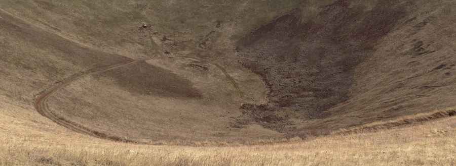
Is the road to Mount Vayots unpaved?
Yes. The road is rough and completely unpaved. It climbs to 2,586 meters (8,484 feet) above sea level along the volcano’s ridge, then continues directly into the crater. Inside the crater there are ruins of an old chapel, adding an unusual landmark to the landscape.
How long is the road to Mount Vayots?
The route from Karmrashen village to the crater is about 5.9 kilometers (3.66 miles) long. Only 4x4 vehicles can reach the top. The weather changes quickly here — in autumn, you can start the drive in dry conditions and reach snow-covered slopes within a few hundred meters.
Is the road to Mount Vayots worth the drive?
Yes. The road offers dramatic views of the surrounding highlands and the volcano’s crater. Because it leads directly into the cone of an extinct volcano, it’s one of the most unusual drives in Armenia.
Pic: Michael Menshikoff