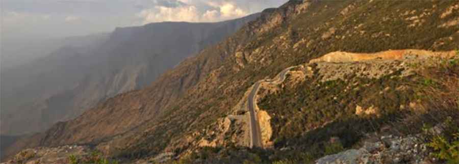
Road to Altuwair: Navigating the 9.57% Gradient in the Asir Mountains
Reaching an elevation of 2,618m (8,589ft) above sea level, Altuwair is a high mountain town located in the Asir (Asīr) Region of southwestern Saudi Arabia. The ascent is one of the most demanding paved climbs in the Asir Mountain Range, requiring high-performance braking and cooling systems.
| Road facts: Road to Altuwair | |
|---|---|
| Location | Asir Region, Saudi Arabia |
| Elevation Gain | 1,685 meters |
| Length | 17.6 km (10.93 miles) |
| Average Gradient | 9.57% |
| Route Designations | Route 2212 / Route 3525 |
How is the road to Altuwair?
The ascent to the summit begins at Abs (near the Agadir Hall) and covers a total of 17.6 km (10.93 miles). The route is fully paved and is officially designated as Route 2212 and Route 3525, also locally known as the Al-Namas Road. Despite the paved surface, the drive is technically complex due to its extremely winding nature and a sustained average gradient of 9.57%. With an elevation gain of 1,685 meters over such a short distance, the road features numerous switchbacks and sharp turns that require constant gear shifting.
What are the driving hazards on the road to Altuwair?
The primary hazard on the Al-Namas Road is brake fade and engine overheating. The constant 9.57% incline puts extreme stress on the vehicle's powertrain, especially given the high ambient temperatures common in Saudi Arabia. On the descent, drivers must rely heavily on engine braking to avoid overheating the brake pads on the long, steep ramps. The road is prone to dense mountain fog, which can reduce visibility to less than 10 meters in minutes, making the lack of safety barriers in certain sections a critical risk factor.
Logistics and Technical Preparation
Due to the high altitude of 2,618m, engines may experience a reduction in horsepower. It is essential to check the vehicle's coolant levels and tire pressure before starting the 17-kilometer climb. While the road connects populated mountain areas, fuel stations are sparse along the actual ascent. During the rainy season, the Asir Mountains are subject to flash floods and rockfalls, which can deposit debris on the paved surface, requiring high levels of alertness at every blind curve.
Operational Strategy
Navigating the Route 2212 requires a defensive driving approach. The road is used by local traffic and light commercial vehicles, and the narrow curves often do not allow for wide passing margins. It is recommended to maintain a steady speed and avoid aggressive acceleration to manage fuel consumption on the steep climb. In the event of heavy fog or rain, it is standard practice to use low-beam headlights and hazard lights to remain visible to oncoming traffic on the tightest switchbacks near the Altuwair summit.
Road suggested by: jorge manuel gómez sánchez
Pic: Faisal Al-shehri