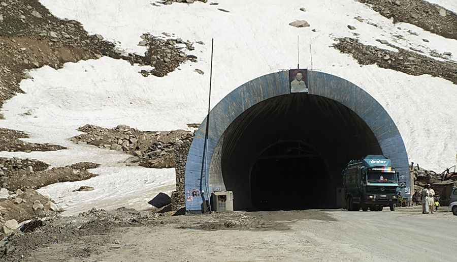
Driving through the hostile and toxic Salang Tunnel in the Hindu Kush Mountains
Salang Tunnel is a high mountain tunnel at an elevation of 3,400m (11,154ft) above sea level located in Afghanistan. The tunnel has limited lighting, inadequate ventilation, and is marred by potholes.
Where is Salang Tunnel?
The tunnel straddles Parwan and Baghlan provinces, in the northeastern part of the country, not far from the border with Pakistan.
When was Salang Tunnel built?
Constructed by the Soviet Union, the tunnel was completed in 1964 and at that time, it held the title of the world's highest road tunnel.
How long is Salang Tunnel?
The tunnel spans 2.67 kilometres (1.66 mi) and serves as a bypass for the dangerous Salang Pass. Situated on the A-76 road, it connects Afghanistan's capital city, Kabul, to the northern provinces. The road leading to the tunnel is primarily a two-lane highway, winding through perilous switchbacks in the mountains. Due to heavy traffic, the road within the tunnel remains unpaved.
How busy is the Salang Tunnel?
Originally designed for a daily capacity of 1,000 to 2,000 vehicles, the tunnel now accommodates between 7,000 and 10,000 vehicles daily. During adverse conditions, especially in winter, lorries often stretch for 15km down the switchbacks at both tunnel ends. Travellers are advised to stay updated with the latest information, given the risks such as terrorist attacks, ongoing armed conflicts, kidnappings, and a high crime rate.
How dangerous is Salang Tunnel?
Located in the heart of the rugged Hindu Kush Mountains, the Salang Tunnel is often cited as one of the world's most dangerous tunnels. The risks of crashes and carbon monoxide poisoning are significant. Poor ventilation and lighting, compounded by dust and fumes, often reduce visibility considerably. Despite its risks, the tunnel remains operational year-round.
Pic: By Michal Vogt - [1], CC BY-SA 2.0, https://commons.wikimedia.org/w/index.php?curid=7335181