How to drive the unpaved pass of Kotal-e Korgah in Daykundi?
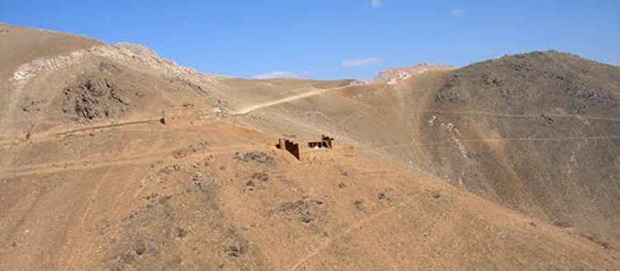
Kotal-e Korgah is a high-altitude mountain pass at an elevation of 3,204m (10,511ft) above sea level, located in the Daykundi Province (also spelled Daikundi) of central Afghanistan. Technically, the route is one of the most isolated unpaved tracks in the central highlands, demanding a high-clearance 4x4 vehicle and a strict logistical protocol due to the extreme volatility of the region and the total absence of emergency infrastructure.
| Road facts: Kotal-e Korgah | |
|---|---|
| Location | Daykundi Province, Afghanistan |
| Elevation | 3,204 m (10,511 ft) |
| Length | 16.4 km (10.19 miles) |
| Surface | Unpaved (Dirt and loose rock) |
What is the technical difficulty of the Kotal-e Korgah road?
The road to the summit is 16.4 km (10.19 miles) long, running south-north from Dahane Sarmaqul to Mahmude Khusk. Technically, the track is completely unpaved, featuring steep gradients and narrow sectors that make it impossible for two vehicles to pass simultaneously. Operating a vehicle at 3,200m in this sector requires a high-torque 4x4 system, as the surface is composed of loose rock and compressed dirt that can become impassable after heavy snowfalls, which occur unpredictably throughout the year in the central part of the country.
What are the logistical hazards of driving in Daykundi?
Logistically, Kotal-e Korgah is situated in a high-risk area where situational awareness is the primary safety requirement. Technically, the road offers no safety barriers or emergency support. Safety protocols mandate a self-sufficient expedition setup, as any mechanical failure or obstruction can lead to prolonged isolation in a region with highly volatile security conditions. Drivers must account for the lack of communication networks and the possibility of armed conflict in the vicinity, making it one of the most logistically complex transits in central Afghanistan.
How to manage vehicle mechanics on the Daykundi highlands?
The 16.4 km ascent and subsequent descent put extreme stress on the drivetrain and suspension components. Technically, the high-altitude dirt track causes significant dust ingestion for the engine; ensuring a clean air filtration system is a mandatory prerequisite. Before attempting the transit toward Mahmude Khusk, a full inspection of the braking system and tire integrity is essential. Given the regional instability and the technical nature of the climb, a "zero-stop" strategy is recommended, maintaining a steady pace to avoid getting bogged down in soft soil or being exposed in open sectors of the pass.
Road suggested by: Hugh Wilson
Pic: Muzafar Ali Oruzgani