How to drive the unpaved road to Kōtal-e Shakar Khāşah?
Kōtal-e Shakar Khāşah is a high mountain pass at an elevation of 3,270 m (10,728 ft) above sea level, located in Khwahan District, in Afghanistan.
Where is Kōtal-e Shakar Khāşah?
The pass is situated in Badakhshan Province, in the northeastern part of the country, near the left bank of the Panj River (which forms the border with Tajikistan).
Is the road to Kōtal-e Shakar Khāşah unpaved?
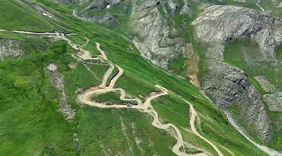
Yes, the road to the summit is completely unpaved. It features extremely steep gradients, narrow ledges, countless blind bends, and tight hairpin turns. A high-clearance 4x4 vehicle is strictly required. Along the way, drivers must contend with heavily washboarded sections, sheer drop-offs without guardrails, and seasonal river crossings caused by snowmelt.
How long is the road to Kōtal-e Shakar Khāşah?
The route is 25.9 km (16.1 mi) long, running roughly south-to-north from Jerwu Bala to Kham-e Ish Darah.
How to drive to Kōtal-e Chahār Rāh?
Continuing north beyond the summit, the track leads directly toward Kōtal-e Chahār Rāh, another high mountain pass sitting at an elevation of 3,051 m (10,010 ft) above sea level.
Is the road to Kōtal-e Shakar Khāşah open year-round?
No. Set high in the rugged Badakhshan Mountains of the Hindu Kush range, the road is not plowed in winter and remains blocked by heavy snow for much of the year, typically remaining accessible only between late spring and early autumn.
Road suggested by: Hugh Wilson
Pic&video: Emran Wadan