How to drive the unpaved road to Darzak Pass in Badghis Province?
Kotal-e Darzak (Darzak Pass) is a high-mountain pass reaching an elevation of 1,308 meters (4,291 ft) above sea level in Badghis Province, northwestern Afghanistan. Crossing the Band-e Turkestan range, the unpaved dirt track connects the Qadis valley system with the isolated Murghab River basin.
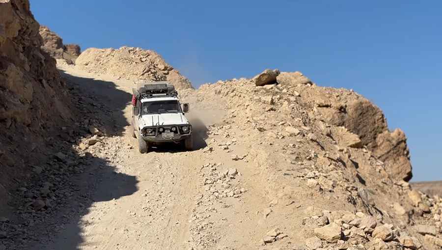
| Road facts: Darzak Pass (Kotal-e Darzak) | |
|---|---|
| Location | Badghis Province (Qadis / Jawand Districts), Afghanistan |
| Distance | 30.6 km (19 miles) from Jawand |
| Elevation | 1,308 m (4,291 ft) above sea level |
| Mountain Range | Band-e Turkestan (Western Hindu Kush) |
| Surface | Unpaved, non-engineered dirt and rock track |
| Vehicle Recommendations | Heavy-duty 4x4 vehicles or local high-clearance trucks only |
| Access Status | Seasonal (Typically impassable during winter snowpack) |
Where is Darzak Pass located?
The pass, also known locally as Darzak-e Gazistan, lies directly on the district border between Qadis and Jawand in northwestern Afghanistan. It cuts through the crest of the Band-e Turkestan mountain range, a sub-range of the western Hindu Kush.
Is the road to Darzak Pass unpaved?
Yes. The route over the pass is a heavily eroded, non-engineered dirt and rock track. Lacking structural pavement, drainage, or side barriers, transit is limited strictly to high-clearance 4x4 vehicles, local heavy trucks, or pack animals.
How long is the road to Darzak Pass?
Starting from Jawand, the drive to the summit spans 30.6 kilometers. The track climbs through steep terrain to cross the main ridge, linking the isolated communities of the Murghab River basin with the valleys of Qadis.
Is the road to Darzak Pass open year-round?
No. Set high in the Band-e Turkestan ridge, winter snowpack and heavy seasonal mud make the unpaved track impassable for motor vehicles throughout the cold weather months.
Road suggested by: Hugh Wilson
Pic&video: Emran Wadan