How to drive the riverbed track to Kotal-e Kurang in Badakhshan
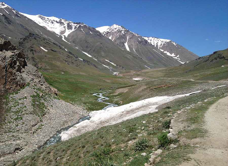
Kotal-e Kurang is a high mountain pass at an elevation of 3,363 meters (11,033 ft) above sea level, located in the Badakhshan Province of Afghanistan. The track to the pass often disappears into riverbeds and deep mud, following the natural flow of snowmelt through the Hindu Kush mountains.
Where is Kotal-e Kurang located?
The pass is situated in the remote northeastern corner of Afghanistan, within the Badakhshan Province. The area is extremely isolated, with no cell service or permanent settlements along most of the road to the pass.
Is the road to Kotal-e Kurang unpaved?
The road to the pass is entirely unpaved and is considered one of the roughest tracks in the region. The surface consists of loose gravel, deep mud, and sections where the roadbed is simply the rocky bottom of a river.
Can I drive my vehicle to Kotal-e Kurang?
Much of the track follows the Kurang Valley, where the roadbed is constantly shifting due to landslides and river erosion. You’ll need a high-clearance 4x4 with a snorkel, as water crossings are frequent and can be deep depending on the season. The vehicle must be capable of handling constant water crossings and rough, unmaintained terrain for more than 12 hours. The track is often blocked by large boulders that have fallen from the cliffs.
How long is the road to Kotal-e Kurang?
The road is 139 kilometers (86 miles) long running from Fayzabad to Lake Shiva. Due to the terrible state of the track, average speeds rarely exceed 15 or 20 km/h, making the full crossing a 12 to 14-hour drive. You must carry auxiliary fuel, as the sustained low-gear work in first and second gear will double the normal fuel consumption of any vehicle.
Is the road to Kotal-e Kurang open in winter?
Set high in the Hindu Kush range, the pass is completely impassable from late October until June due to heavy snow and ice. Even during the summer months, sudden storms can turn the track into a slippery mud slide that can trap vehicles for days. During the spring snowmelt, the river crossings become too deep and fast-moving to be crossed safely.
Road suggested by: Hugh Wilson
Pic: R