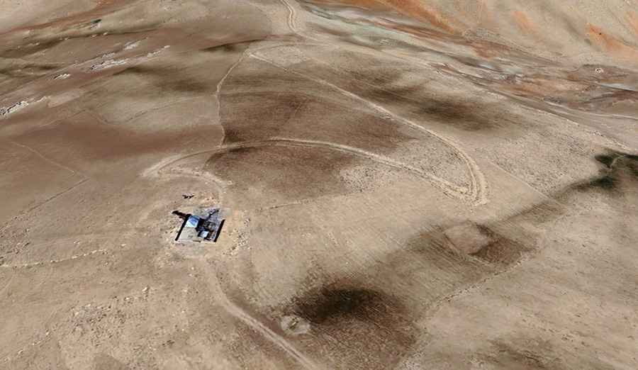
Koh-e Nihalah: Driving the 25-hairpin mountain track in Samangan
Koh-e Nihalah is a high mountain peak reaching an elevation of 2,980 meters (9,776 ft) above sea level, located in the Samangan Province of northern Afghanistan. The road to the summit is a raw, unpaved track that scales the jagged ridges of the Hindu Kush to reach a communication tower. The physical reality of driving this route involves managing a 8.9-kilometer ascent with 25 sharp hairpin turns on a crumbling shale surface, where the elevation gain of 876 meters tests the vehicle's low-range torque and cooling system to their absolute limits.
| Road facts: Koh-e Nihalah (Samangan) | |
|---|---|
| Location | Samangan Province, Afghanistan |
| Elevation | 2,980m (9,776ft) |
| Length | 8.9 km (5.5 miles) from Ruy Doab |
| Hairpin Turns | 25 switchbacks |
How difficult is the 25-hairpin road to Koh-e Nihalah?
The 8.9-kilometer climb starting from Ruy Doab is a high-intensity mechanical operation. Over this short distance, the elevation gain is nearly 900 meters, which means the 9.84% average gradient is deceptive; many ramps exceed 15% on a surface of shifting shale and loose rocks. The logistics of the drive are dominated by 25 hairpin turns that are so tight that long-wheelbase 4x4s will struggle to clear them in a single maneuver. This forces the driver into multi-point turns on the very edge of unprotected drops, where the loose mountain roadbed provides almost no traction for the tires.
What are the hazards on the Koh-e Nihalah mountain track?
The primary hazard on the Koh-e Nihalah hairpins is the extreme isolation combined with the crumbling nature of the Hindu Kush terrain. The road is carved into arid slopes where erosion is constant, and a single rain event can wash out entire sections of the track. At nearly 3,000 meters, a naturally aspirated engine will lose about 30% of its power. The physical reality of restarting a vehicle on a 15% incline of loose stones is a thermal nightmare for the clutch. There are no guardrails or safety barriers, and the vertical exposure on the 25 switchbacks is total, requiring absolute focus on the vehicle's footprint.
What is the logistical reality of the 2,980m Samangan transit?
Reaching the summit requires a 4x4 vehicle with high ground clearance and a functioning low-range gearbox. The logistics of the route are dictated by the terrain: there are zero services, no medical aid, and no mechanical help for hundreds of kilometers. The high-vibration environment of the rocky Afghan tracks will test every seal and bolt on your car. The thin, dry air means the radiator has to work at maximum capacity to prevent the engine from boiling over during the sustained low-gear crawl. You must carry auxiliary fuel, extra water, and professional recovery gear like sand ladders and a high-lift jack.
What mechanical prep is needed for the Koh-e Nihalah climb?
Before leaving Ruy Doab, verify that your cooling system is flushed and the fan is kicking in correctly; the slow-speed climb will push the motor's temperature to the red line. Check your brake pads and fluid, but your technique is more important: do not ride the pedal on the 25 hairpins during the descent. You must use engine braking and low gears to hold the vehicle's weight. Your tires must be heavy-duty All-Terrain with reinforced sidewalls to resist the sharp shale that can slice through rubber. In this remote part of Samangan, your vehicle's mechanical integrity is the only safety net against the harsh reality of the high-altitude Afghan peaks.