Kotal-e Aq Rabat: Driving the 43km unpaved track in Bamyan
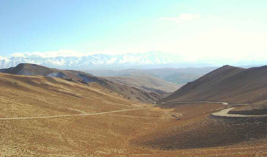
Kotal-e Aq Rabat is a high mountain pass at an elevation of 3,362 meters (11,030 ft) above sea level, located in the Sayghan District of the Bamyan Province, Afghanistan. Situated within the rugged foothills of the Hindu Kush range, the pass is crossed by a long unpaved mountain road.
| Road facts: Kotal-e Aq Rabat | |
|---|---|
| Location | Sayghan District, Bamyan Province (Afghanistan) |
| Elevation | 3,362 m (11,030 ft) |
| Length | 43.3 km (26.9 miles) |
| Surface | Unpaved (Compacted dirt, sand, and loose rocks) |
How long is the road through Kotal-e Aq Rabat?
The unpaved mountain road is 43.3 kilometers (26.9 miles) long, running north-south to connect the town of Sayghan with Kadalak. The route climbs through an arid high-altitude desert, reaching its highest point at the 3,362-meter summit crest. The track consists of a single unpaved lane used by local transport trucks and agricultural vehicles, with no asphalted sections or roadside facilities.
What are the road conditions on the Kotal-e Aq Rabat pass?
The entire 43.3-kilometer road is unpaved, featuring a rough surface composed of deeply corrugated dirt, loose mountain stones, and heavy sand pockets. The steep climbing sections have no lateral protections or safety barriers against the dropping slopes. Due to the loose nature of the gravel ramps and the soft sand accumulation that reduces tire grip, a high-clearance 4x4 vehicle is required to climb the upper sectors without getting stuck.
Is the Kotal-e Aq Rabat road open in winter?
Due to its extreme 3,362-meter altitude, heavy winter snowfall and thick ice completely block the pass from late autumn until early spring, leaving the route entirely impassable. During the spring thaw and rainy season, the unpaved trackbed is highly prone to sudden flash floods and mudslides that wash away entire sections of the lane, leaving deep ruts and exposed river stones across the track profile.
Road suggested by: Hugh Wilson
Pic: Hasan Malistani