Driving Shah Mansoor Pass, Afghanistan's Majestic Heights
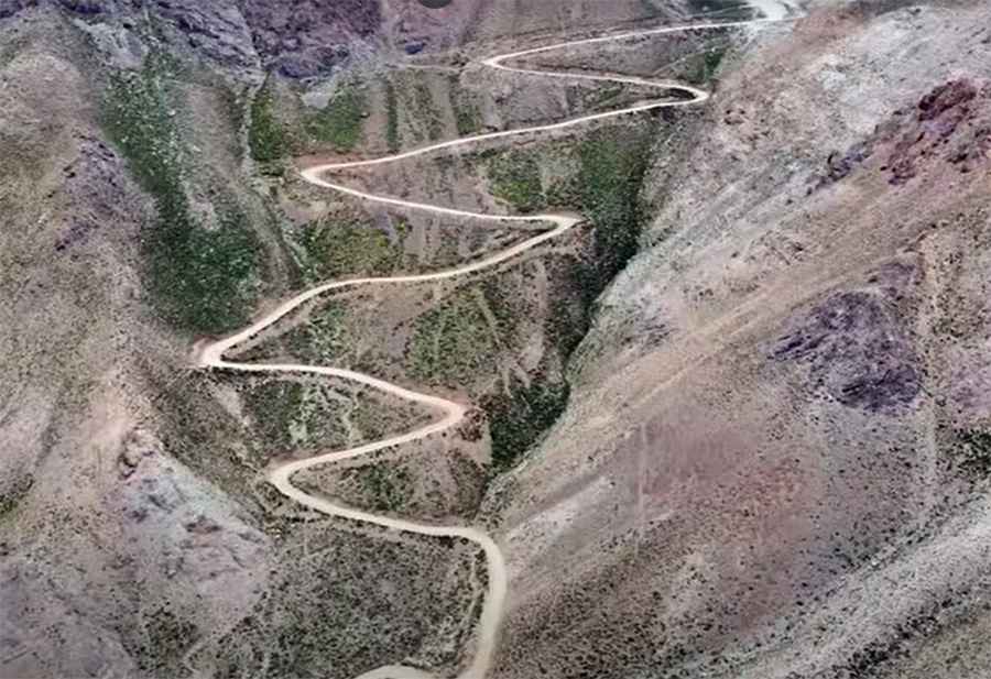
Kotal-e Shah Mansoor is a high mountain pass at an elevation of 3.638m (11,935ft) above the sea level, located in Ghazni Province, in Afghanistan. It's one of the highest roads in the country.
How challenging is the road through Mansoor Pass?
Despite its unpaved surface, most passenger vehicles can traverse the road. However, travelers should be prepared for an adrenaline-pumping experience. This route is characterized by countless twists, turns, and particularly challenging steep inclines. Brace yourself for the road's 15 sharp hairpin turns. Those with a fear of heights might find it beneficial to stay focused on the path ahead, as certain sections can be intimidating to navigate.
How long is the road through Mansoor Pass?
The road is 43.9 km (27.27 miles) long, running from Pashi to Sang-e-Masha.
Is the road through Mansoor Pass dangerous in winters?
Set high in the eastern part of Afghanistan, the pass undergoes a transformation during winter. Snow blankets the route, making the already challenging drive even more treacherous and slippery. For safety and a smooth journey, always check the latest road conditions before embarking on this drive.
Road suggested by: Hugh Wilson
Pic&video: Manji Studio منجی استدیو