What are the most spectacular roads in Afghanistan?
Afghanistan is a landlocked country, located on the Iranian Plateau, at the crossroads of Central Asia and South Asia. Despite its natural wonders, right now is better to avoid all travel to Afghanistan, due to terrorism, risk of wrongful detention, kidnapping and crime.
The country is 652,864 km2 (252,072 sq mi), and bordered by 6 countries: Pakistan, Iran, Turkmenistan, Uzbekistan, Tajikistan and China. We advise against all travel to and within Afghanistan. Border crossing points may be closed without notice, especially during increased border tensions or concerns of an increased risk of a terrorist attack. There are Taliban checkpoints on roads throughout the country and in Kabul.
Despite the risks, the country features many spectacular roads, some of them among the most challenging in the world, on a landscape characterized by rugged mountains, vast deserts, and fertile valleys. Navigating the Kabul-Jalalabad Highway is a difficult drive following the Kabul River Gorge for 64 kilometers (40 mi) in Taliban territory. This two-lane highway runs through 600-meter-high cliffs. Salang Pass is a mountain pass at 3,878m (12,723ft) on the boundary between Parwan and Baghlan provinces. Back to war times, Highway 1 is the Afghan Highway to Hell. And the hostile and toxic Salang Tunnel sits at 3,400m (11,154ft) above sea level, with limited lighting, inadequate ventilation, and marred by potholes.
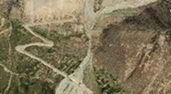
A wild unpaved road to Band-e Ghuk
Pereval Guk is a high mountain pass at an elevation of 2.907m (9,537ft) above the sea level, located in Chaghcharān district, Ghor Province in central Afghanistan.
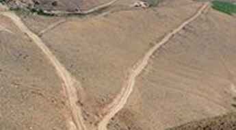
Mihman Yoli Pass is one of the toughest tracks in the world
Mihman Yoli Pass is an international high mountain pass on the border of Afghanistan and China, at an elevation of 4.787m (15,705ft).
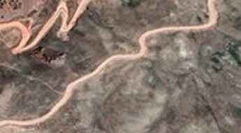
Courage is required to drive to the summit of Kotal-e Tamazan
Kotal-e Tamazan is a high mountain pass at an elevation of 2.413m (7,916ft) above the sea level, located on the border of Urozgan and Daykundi provinces of Afghanistan.
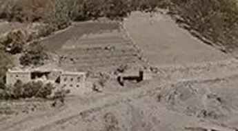
The road to Shatu Pass is recommended for drivers with strong nerves
Kotal-e Shatu is a high mountain pass at an elevation of 3.405m (11,171ft) above the sea level, located in Bamyan Province, Afghanistan. The security situation in the country remains extremely volatile.
Dare to drive the dangerous Kōtal-e Darah-ye Rāst
Kōtal-e Darah-ye Rāst is a high mountain pass at an elevation of 4.188m (13,740ft) above the sea level, located on the border of Kabul and Parwan Provinces, in Afghanistan,
The road to Kotal-e Unak is not for the faint of heart
Kotal-e Unak is a high mountain pass at an elevation of 3.056m (10,026ft) above the sea level, located in Daykundi Province, in the central part of Afghanistan.
Travel guide to the top of Pereval Torbulak
Pereval Torbulak is a high mountain pass at an elevation of 2.885m (9,465ft) above the sea level, located in Ghor Province, in central Afghanistan.
A gravel road to the summit of Kotal-e Yamahgak
Pereval Yamagak is a high mountain pass at an elevation of 2.481m (8,139ft) above the sea level, located in central Afghanistan.
The road to Sangarkish Pass is not for the faint of heart
Kotal-e Darwazah (Sangarkish Pass) is a high mountain pass at an elevation of 3.202m (10,505ft) above the sea level, located in Daykondi Province, in the central part of Afghanistan. If you're afraid of heights, it's probably best to keep your eyes forward.
Dare to drive the dangerous Kotal-e Lashkar Rah
Kotal-e Lashkar Rah is a high mountain pass at an elevation of 2.934m (9,625ft) above the sea level, located in Ghor Province, in central Afghanistan.
Navigating Shah Mansoor Pass, Afghanistan's Majestic Heights
Kotal-e Shah Mansoor is a high mountain pass at an elevation of 3.638m (11,935ft) above the sea level, located in Ghazni Province, Afghanistan.
Adventure along the wild road to Kotal-e Aq Rabat
Kotal-e Aq Rabat is a high mountain pass at an elevation of 3.362m (11,030ft) above sea level, located in Sayghan Distrct, in Bamyan Province of Afghanistan.
Driving the heights of Sabz Chob Pass in Afghanistan's Ghazni Province
Sabz Chob is a high mountain pass at an elevation of 2.917m (9,570ft) above the sea level, located in Jaghori District in Ghazni Province of Afghanistan.
Navigating the hazardous road to Kotal-e Gardish Pass
Kotal-e Gardish is a high mountain pass at an elevation of 3.058m (10,032ft) above the sea level, located in Ashtarlay District of Daykundi Province in Afghanistan.
The paved Khyber Pass is part of the Silk Road
Khyber Pass is a high mountain pass at an elevation of 1,070m (3,510ft) above sea level, located in the Khyber Pakhtunkhwa province of Pakistan. The road through the pass is the main route between Pakistan and Afghanistan.

