7 Mountain Driving Tips for California’s Remote Roads
Sonora Pass can shift from an easy summer crossing to a closed winter route once snow arrives. Farther south, Lanfair and Ivanpah Roads cross Mojave terrain where storms can damage the surface. In Northern California, Howland Hill Road trades pavement for a narrow route through old-growth redwoods.
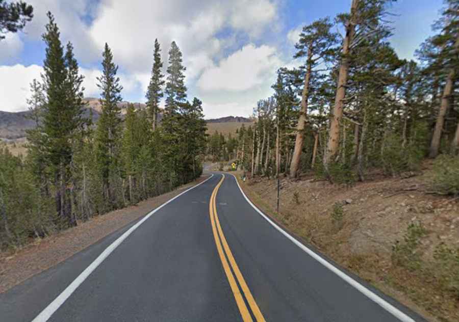
Those California mountain roads and backcountry routes demand more than fuel and directions. But don’t worry! We’ll discuss the seven things you should know first before driving on these roads.
1. Check the route before trusting the navigation app
Navigation apps are useful for directions. They are less reliable for fast-changing road access.
Sonora Pass on State Route 108 is a paved Sierra crossing with recurring winter closures. Review Caltrans QuickMap before departure for closures, chain controls, construction, and incidents.
Desert routes deserve the same skepticism. The National Park Service warns that third-party navigation can display inaccurate road status inside Mojave National Preserve. Its current road conditions provide more reliable access information.
Recheck official sources on the morning of the drive. Snow, wildfire restrictions, washouts, or roadwork can change access after a route was saved.
2. Match the vehicle to the surface and grade
Useful mountain driving tips start with the road under the tires, not the badge on the grille.
Paved Sierra highways and rough desert tracks place different demands on a vehicle. Inspect tire tread and pressure before departure. Confirm the brakes are in good condition. Carry traction equipment when the route or current restrictions require it.
Vehicle loading deserves attention too. Extra weight changes braking distance and handling on steep grades.
Howland Hill Road offers a useful contrast. The route through Jedediah Smith Redwoods State Park is mostly unpaved and narrow. The National Park Service states that motorhomes, recreational vehicles, and trailers will not fit.
When driving mountain roads, slow before sharp curves instead of braking hard after entering them. California Department of Motor Vehicles guidance also advises drivers to shift into a lower gear before descending a steep hill.
3. Know your range before a desert road trip
Fuel assumptions become expensive once the next reliable station is behind you.
Mojave National Preserve has no fuel inside the preserve, according to National Park Service visitor information. Know the vehicle’s realistic range before entering the desert. Leave enough fuel for a detour or an unexpected turnaround.
Lanfair and Ivanpah Roads combine paved and graded-dirt sections. Rain can leave washboard, debris, mud, or damaged shoulders along parts of the route.
For a desert road trip, carry enough drinking water for everyone in the vehicle. Bring a usable spare tire and basic emergency equipment as well. Leave extra travel time because rough surfaces can reduce average speed even when the mileage looks modest.
4. Save the route before cell service disappears
Remote travel becomes harder when every useful detail lives inside an app that needs data.
Download offline maps before leaving coverage. Save coordinates for major junctions and alternate exits. Keep fuel stops and lodging details accessible without a signal.
Share the route and expected return time with someone who will notice if you miss the check-in. Roadside-assistance information and emergency contacts should also remain available offline.
Trips far beyond reliable cellular coverage may justify a satellite communicator or another emergency device suited to the route.
Signal loss itself is inconvenient. The bigger problem begins when a road closes, or a junction is missed, and the alternate route never downloaded.
5. Check the vehicle documents before leaving reliable services
Remote-road readiness also includes a quick paperwork review.
Confirm that the registration is current and proof of insurance is accessible. The driver’s license should also be valid before entering isolated areas.
Check the registration expiration date if the trip falls close to the renewal period. If the deadline is approaching, handle the vehicle registration renewal before departure instead of carrying an avoidable administrative issue into the trip.
Save policy information and roadside-assistance numbers offline. Weak service shouldn’t block access when those details are needed.
6. Read weather and terrain as one problem
California mountain roads can cross major changes in elevation within a relatively short distance. Those elevation changes can also bring sharp temperature differences.
Higher sections may have colder temperatures, reduced visibility, wet pavement, or ice even when conditions are mild below. Desert routes create the opposite challenge. Heat places more stress on tires and cooling systems, while occupants may need more water than expected.
Rain can change an unpaved road quickly. Hard-packed dirt can become muddy. Gravel can lose grip, while shoulders may soften near washes or drainage areas.
Another useful mountain driving tip is to increase following distance when traction drops. Slow before blind curves and avoid abrupt steering inputs on loose surfaces. Smooth inputs give the vehicle more time to respond when grip changes.
What is the best way to drive in the mountains?
Control speed before the curve or descent begins. Use a suitable lower gear on long downhill sections. Increase following distance when traction drops, and obey posted restrictions instead of assuming four-wheel drive can compensate for poor conditions.
7. Turn around before the road forces the decision
Remote-road judgment often comes down to recognizing when the available safety margin has disappeared.
Turn back if road damage exceeds the vehicle’s clearance. Do the same when fuel reserve is falling faster than expected, or weather has deteriorated beyond conditions you can safely handle.
Traction is another clear signal. Continuing makes little sense when the road requires equipment the vehicle does not carry. Washed-out sections or damaged shoulders also deserve caution when the safe line is unclear.
Driver experience counts. An unpaved route may be technically open while still exceeding the driver’s comfort level or the vehicle’s capability.
Continuing because the destination looks close can turn a manageable problem into a difficult recovery. Leave enough fuel, daylight, traction, and confidence to reverse course while the choice is still yours.
Run one final remote-road check
Before leaving dependable services behind, confirm:
- Current road status and seasonal access
- Tire condition, clearance, brakes, and traction equipment
- Fuel range, drinking water, and emergency supplies
- Offline maps and shared route details
- Registration, insurance, and driver’s license
- Weather, visibility, and surface conditions
- Realistic turnaround point if the drive changes
The review should take only a few minutes. Missing one item can cost far more time once the nearest service or easy turnaround is miles away.
Give yourself room to change course
Remote California roads reward drivers who leave themselves options. Accurate route information and realistic vehicle limits can mean the difference between continuing safely and committing to conditions that no longer suit the car or driver.
Before leaving reliable services, verify the route and current conditions one last time. If the road, weather, fuel reserve, or vehicle raises a serious concern, turn back or choose another route before the decision becomes harder.