You Could Be Driving One of the Most Dangerous Highways in the US Right Now
Quick answer: By fatal crash rate, I-4 in Florida is generally cited as the deadliest highway per mile in the US. By total number of deaths, I-10 and I-95 top the list. A 10-mile stretch of I-45 through Houston has the worst fatal crash record of any highway segment in the country, and in the Northeast, a stretch of I-80 through Pennsylvania's Pocono Mountains has become one of the most crash-prone corridors around, mostly because of overloaded trucks, steep grades, and shoulders barely a foot wide.
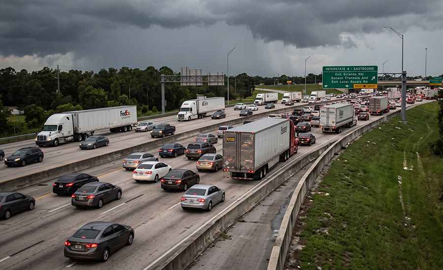
You've probably driven on one of these highways without knowing it. Maybe you drive one every week. Dangerous doesn't always mean remote mountain passes with hairpin turns and no guardrails, sometimes it's a totally ordinary stretch of interstate that just happens to carry too much traffic, too much weight, and too little margin for error.
Here's what the data actually says about the highways that carry the worst reputations, why some of them are getting worse while others have actually gotten safer, and why one stretch in particular deserves more attention than it gets.
Which highways have the highest fatal crash rate per mile?
I-4 in Florida holds the title here. The 132-mile stretch between Tampa and Daytona Beach has one of the highest fatal crash rates in the country, commonly cited above one death per mile depending on the data year. That's a strange thing to sit with: a highway that most people associate with theme park road trips is also, statistically, one of the deadliest to drive per mile in America. Heavy tourist traffic, unfamiliar out-of-state drivers, and dense merging points all play a role.
Which highway has the most total fatalities?
That distinction usually goes to I-10, which stretches across the entire southern US from California to Florida, with recent counts putting it well over 300 fatal crashes in a single year, more than any other highway in the country. I-95 isn't far behind. Because I-10 and I-95 are so long, and carry so much freight and commuter traffic across so many states, the raw death toll adds up fast even where the per-mile rate isn't the worst in the country.
Why is I-95 called "America's Deadliest Mile"?
I-95 runs 1,919 miles from Maine to Miami and loses close to 300 people a year across its full length, or roughly 15 fatal crashes per 100 miles. One particular stretch earned its own grim nickname: a single mile in Fort Lauderdale, Florida, between Marina Mile Boulevard and the I-595 interchange, has been tied to 24 deaths over a 20-year span. It's not the longest or steepest stretch of road in the country, it's just a chokepoint where merging traffic, high speeds, and heavy volume collide, literally.
Is any highway actually getting more dangerous, not just staying dangerous?
Yes, and Houston's I-45 is the clearest example. A 20-year federal crash analysis found that one 10-mile segment of I-45 through central Houston averages close to eight fatal crashes a year, the worst figure recorded for any highway segment in the country. I-45 as a whole, from Dallas to Galveston, averages roughly 56.5 fatal crashes per 100 miles, one of the highest rates of any interstate in the country, driven heavily by the Houston segment.
Houston's rapid growth is a big part of the story, more people, more commuters, more freight, on a highway that wasn't designed for today's volume. Atlanta's I-285 tells a similar story on a smaller scale: it's not the deadliest highway overall, but per 10-mile stretch, congestion has pushed it toward the top of national rankings, with a reported 0.35 deaths per mile.
Has any highway actually gotten safer?
Not every story here is grim. Vasco Road in California is a solid example of what happens when a road's traffic outgrows its design, and what happens after someone actually fixes it. Daily traffic on the road more than doubled, from around 10,000 to over 22,000 vehicles, and crashes climbed right along with it, 72 crashes in just two years in the early 2000s. Local agencies responded with a coordinated safety corridor program targeting speeding and aggressive driving, and within a few years, collisions dropped by 36 percent. It's a useful reminder that a lot of what makes a highway dangerous is engineering and enforcement falling behind traffic growth, not something permanent or unfixable.
What about I-80? Isn't that just a cross-country route?
It is, and for most of its length, that's exactly what it is: a long, unremarkable stretch of interstate connecting the East and West coasts. But one section of it, cutting through Pennsylvania's Pocono Mountains in Monroe County, has quietly become one of the most dangerous truck corridors in the Northeast.
Here's the problem. That stretch of I-80 was engineered in the 1960s to handle a little over 10,000 vehicles a day. Today it carries roughly 70,500 vehicles daily, a huge share of them tractor-trailers running the Ohio-to-New York City freight corridor. The road wasn't built for that kind of load, and it shows. Steep descents wear down brakes and tires faster than flatter terrain. Winter ice and sudden snow squalls have triggered some of the worst multi-vehicle pileups in the region. Long-haul drivers pushing past federal hours-of-service limits add fatigue into the mix. And on parts of this stretch, the shoulder narrows to about a foot wide, nowhere close to the 10 to 12 feet you'd want if a truck needs to pull off safely.
None of that shows up if you're just glancing at a map. It's a highway that looks completely ordinary until you understand what's actually happening on it every day.
What does the research actually say about why highways are dangerous?
Research from the National Highway Traffic Safety Administration and the Insurance Institute for Highway Safety keeps pointing to the same handful of factors: speed, road geometry (how sharp the curves are, how wide the shoulders are, how the road transitions at on-ramps and interchanges), and whether a road's design actually matches what drivers can survive if something goes wrong. Speed in particular is treated as a foundational variable, because it directly changes how survivable a crash is, not just how likely one is. Highways, statistically, are actually safer than ordinary local roads, since limited access points, median barriers, and consistent speed limits remove a lot of the conditions that cause crashes elsewhere. The problem shows up when a highway's design hasn't kept pace with how much traffic, or how much truck weight, it's actually carrying, which is exactly the situation on I-80 through the Poconos.
Have other countries figured out how to make highways safer?
Sweden has, more than most. In 1997, Sweden adopted a road safety policy called Vision Zero, built on a simple idea: no death on the road is acceptable, so design the whole system, roads, speed limits, vehicles, around human tolerance for a crash, not around getting somewhere faster. It worked. Sweden's traffic deaths dropped from 541 a year in 1997 to around 200 today, even as the number of cars on the road went up. Sweden now loses roughly 3 people per 100,000 residents to traffic deaths each year, compared to roughly 12 per 100,000 in the US. The idea has spread well beyond Sweden. New York City adopted its own Vision Zero plan in 2014, lowering speed limits and redesigning intersections, and cut annual traffic deaths by nearly a third by 2018, a record low of around 202 deaths, though the gains partly reversed in 2020 as speeding surged on emptier pandemic-era streets.
What actually makes a highway dangerous, when you put it all together?
It's rarely just one thing. The highways on this list share a few overlapping problems: traffic volume that's outgrown the road's original design, heavy freight and commercial truck traffic, weather that turns manageable driving into a genuine hazard, and long hours behind the wheel for the drivers who use these roads for a living. Scenic mountain roads get most of the attention in conversations about dangerous driving, switchbacks, cliffsides, no guardrails, that kind of thing. But an overloaded interstate with worn-out infrastructure can be just as unforgiving, it just doesn't look as dramatic in a photo.
What should you actually do if something goes wrong on one of these roads?
If you're ever in a serious crash on a stretch like I-80 through the Poconos, especially one involving a commercial truck, the practical realities get complicated fast: insurance companies for trucking companies, multiple parties who might share fault, and injuries that are often more severe simply because of the size and weight difference between a truck and a passenger vehicle. In Monroe County specifically, this stretch of I-80 sees enough serious truck accidents that a Stroudsburg truck accident lawyer dealing with these cases isn't an unusual thing to need, it's a fairly regular reality for the people who live and drive along that corridor.
The bottom line
Every highway on this list carries real risk, but the risk doesn't always look like what you'd expect, and it isn't always permanent either. Sweden and Vasco Road both show that dangerous roads can get safer with the right changes. Sometimes the danger is a legendary mountain pass, and sometimes it's a completely normal-looking interstate that's just carrying seven times more traffic than it was ever built for. Next time you're merging onto one of these roads, or driving through the Poconos on I-80, it's worth remembering that the ordinary stretches can be just as unforgiving as the famous ones.