Highway Access, Retail Corridors, and Pedestrian Risk in Urban Crash Zones
Lansing’s arterial corridors present a persistent safety challenge. Where highway ramps meet retail strips and pedestrian crossings, drivers face conditions that generate predictable collision patterns. Understanding these conflict zones matters for anyone who travels through the city or has been affected by a crash in these areas.
How Mixed-Use Road Zones Create Predictable Conflict Points
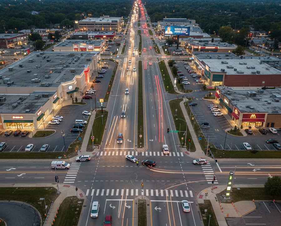
Arterial corridors in Lansing combine fast through traffic, retail access, and pedestrian movement. Drivers, delivery vans, and shoppers share limited space. Frequent turning and braking create constant disruption.
Highway ramps feed vehicles directly into commercial zones. A car leaving I-496 may meet a turning vehicle within seconds. Pedestrian crossings add another conflict in the same short stretch. Small timing errors quickly escalate into crashes.
These locations show repeat collision patterns. Rear-end impacts, side crashes, and pedestrian strikes cluster along retail arterials. The layout concentrates risk into predictable points. Typical conflict patterns in these mixed-use zones include:
- Ramp merges with short decision distances;
- Unexpected braking for retail driveways;
- Pedestrians crossing multiple active lanes;
- Blind exits from parking lots;
- Signal phases that trap turning vehicles.
These conflicts follow identifiable design features. Mapping them helps target redesign instead of blaming isolated drivers.
Why These Crashes Are Often Linked to Design Rather Than Recklessness
Public discussion often centers on speeding and reckless driving. High-profile street racing cases in Lansing reinforce that narrative. Yet many severe crashes on the same corridors involve drivers who were not behaving aggressively. The environment itself creates conditions where ordinary mistakes have serious consequences.
Retail arterials limit visibility in ways that drivers cannot easily overcome. Large signs, dense driveways, and parked vehicles block sightlines. Drivers entering from side streets or shopping centers often see hazards too late. These crashes stem from restricted visual information rather than extreme behavior.
Visual And Decision-Making Limits In Retail Corridors
Complex turning movements increase mental workload. Drivers must judge speed, distance, signal phases, and pedestrian presence at once. Near ramps and multi-lane roads, these decisions happen under time pressure. Small miscalculations quickly become collisions.
Several environmental factors consistently raise cognitive demand in these corridors:
- Frequent driveways interrupt traffic flow;
- Wide crossings increase pedestrian exposure time;
- Multiple signals appear within short distances;
- Lane drops force sudden positioning decisions;
- Ramp traffic mixes with local turning vehicles.
These conditions overwhelm even attentive drivers. Investigators often find that crash clusters follow these layouts rather than patterns of extreme recklessness alone.
The Legal Complexity of Multi-Factor Collisions
Crashes in mixed highway, retail, and pedestrian zones rarely have a single clear cause. Investigators must evaluate speed, spacing, signal timing, and road layout together. A basic crash report lists vehicles, but not the chain of decisions that led to impact.
Several parties often play a role in the same incident. One driver may be moving too fast, another turning into a driveway, while others react late. These layered movements make responsibility harder to define. Legal analysis must go beyond what officers observe at the scene.
In car accident cases in Lansing, attorneys and reconstruction specialists often review corridor design, prior crash history, and complaints about unsafe conditions. High-crash interchanges and retail arterials may show long-standing risk patterns. When a location produces repeated collisions, infrastructure can become part of the legal discussion.
Liability questions in these crashes often involve multiple overlapping factors:
- Driver speed relative to surrounding conditions;
- Signal timing and intersection control design;
- Sight distance blocked by structures or signage;
- Driveway placement near conflict-heavy zones;
- Road markings that fail to guide movements clearly.
These elements shape how responsibility is evaluated. Civil claims, insurance decisions, and public entity liability can all hinge on how the environment influenced driver behavior.
Common Design Features That Increase Risk
Certain roadway layouts appear repeatedly in Lansing crash clusters. These patterns show up near highway ramps, retail corridors, and multi-lane arterials. The same design choices concentrate conflict points in short segments.
These environments compress merging, turning, and stopping decisions. Drivers face high speeds, dense access points, and frequent crossings at once. Even moderate traffic volumes can produce unstable flow.
Several recurring design elements are especially linked to elevated crash risk:
- Short merge lanes near highway exits;
- Driveways placed close to intersections;
- Wide pedestrian crossings without refuge islands;
- Dense signage competing for driver attention;
- Offset intersections with misaligned turning paths.
These features can be modified through access management and signal redesign. Without physical changes, the same locations tend to produce the same types of crashes over time.
Vulnerable Road Users in High-Conflict Corridors
These corridors are risky for more than drivers. Pedestrians, cyclists, and bus riders use the same tight spaces. Bus stops often sit along fast roads next to retail entrances. To reach stores or housing, people end up crossing several active lanes with traffic moving at full speed.
Sidewalks are frequently interrupted by wide driveways. Pedestrians are pushed closer to moving vehicles at each entry point. Cyclists face turning cars, unclear lane markings, and little buffer space. Each added movement increases exposure time in traffic.
These layered risks mean a layout that feels tense for drivers can be far more dangerous for others. Safety planning must account for how non-drivers move through these zones, not just how vehicles flow.
Why Prevention Requires Planning, Not Just Enforcement
Enforcement can reduce dangerous behavior for short periods. Increased patrols and citations may slow drivers temporarily. But policing does not remove the physical conflict points built into certain corridors.
Urban planning choices shape crash patterns long before collisions occur. Retail placement, driveway spacing, and street connections determine how traffic interacts. Dense access along fast arterials forces frequent braking and turning in limited space.
Infrastructure Changes That Reduce Conflict
Traffic engineering can separate movements in time and space. Coordinated signals create safer turning gaps. Protected turn phases reduce exposure to opposing traffic. Medians can limit mid-block left turns that trigger sudden stops.
Access management is especially effective. Consolidating driveways and adding shared entrances lowers conflict frequency. Reducing environmental complexity addresses risk at its source rather than reacting after crashes occur.
Sustained safety gains require redesign, not only enforcement. When crash clusters align with specific layouts, those layouts become the focus of prevention. Treating collisions as system failures allows long-term risk reduction.
Conclusion
Crashes on highway-adjacent retail corridors usually follow the same script. Fast traffic mixes with frequent driveways and crossings in tight spaces. When those pieces overlap, small mistakes turn into predictable collisions. The pattern repeats because the layout repeats.
Prevention here is mostly about the road, not the driver. If signals are packed too close, driveways sit right on the corner, and sightlines are blocked, mistakes happen fast. Even when nobody is “driving crazy.” Police can slow things down for a week or two, but the corridor stays the same. If crashes keep stacking up in the same blocks, that’s the part that needs rebuilding: fewer conflict points for turns, cleaner visibility, and crossings people can actually use.