Exploring the 8 Deadliest Roads in California
From the high-altitude switchbacks of the San Gabriel Mountains to the high-speed desert traverses leading to Las Vegas, California’s road network presents a unique set of lethal variables. Data from the NHTSA Fatality Analysis Reporting System (FARS) identifies specific segments within the Golden State that consistently rank among the top 50 most hazardous roads in the United States. Navigating these routes requires more than standard driving skills; it demands an understanding of micro-climates, topographical traps, and high-velocity traffic patterns.
| California Risk Assessment: Technical Metrics | |
|---|---|
| Deadliest Volume Leader | I-5 (Nearly 1 fatality per mile) |
| Highest Elevation Hazard | SR-2 (Angeles Crest - 7,901 ft) |
| Desert Exposure Risk | SR-62 (100-mile "no service" zone) |
| Wind Warning Sector | I-8 (Devil Canyon - 100 mph gusts) |
1. SR-62: The Solar and Isolation Trap
Stretching 151 miles from Palm Springs to the Arizona border, SR-62 is a lesson in environmental hazards. The primary risk factor is the east-west orientation: during sunrise and sunset, the solar angle causes near-total driver blindness. Combined with a 100-mile stretch east of Twentynine Palms with zero services and a lack of center dividers, head-on collisions at high speeds are statistically frequent.
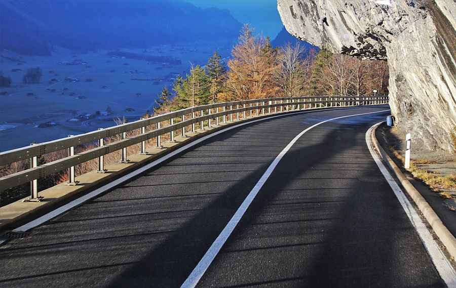
2. SR-2: The Deceptive Angeles Crest Scenic Byway
Rising to 7,901 feet at Dawson’s Saddle, the SR-2 is one of the most technical mountain roads in the country. Its high fatality rate is deceptive; while traffic volume is lower than the interstates, the concentration of blind curves and treacherous 6,000-foot vertical drops results in 1.6 fatalities per mile in its eastern sector. Attentiveness to weight transfer and braking is critical here.
3. I-8: The Devil Canyon Wind Tunnel
Running from San Diego through the In-Ko-Pah Gorge, I-8 is notorious for extreme aerodynamic hazards. Storm-force winds in Devil Canyon can exceed 100 mph, frequently overturning high-profile vehicles. Additionally, high-speed evasion maneuvers near the Alpine Interior Border Checkpoint contribute to a high density of fatal incidents, averaging one death every 1.2 miles.
4. SR-78: The Julian Mountain Sector
This 215-mile route transitions from dense urban areas into the Cuyamaca Mountains. The sector near Banner Hill is particularly infamous for its technical difficulty. Narrow shoulders and steep mountainous grades have resulted in 62 casualties over a 7-year study period, making it a high-distress zone for unprepared drivers.
5. I-40: The "Needle Freeway" and the Bristol Mountains
Crossing the Mojave Desert from Barstow to Needles, the I-40 is a high-speed desert corridor with a violent history—including the 1960s use of nuclear explosives to clear the path through the Bristol Mountains. Modern hazards include extreme thermal stress on tires and road surfaces that become "slick" during rare rain events, leading to high-velocity hydroplaning.
6. I-5: The High-Volume Fatality Leader
The I-5 is the backbone of California, but its 796-mile stretch is a "danger corridor." In Los Angeles County, the sheer traffic density creates a volatility that has claimed over 700 lives in recent years. Statistically, a fatality occurs nearly every mile on this highway, driven by fatigue, lane-splitting accidents, and high-speed congestion.
7. SR-86: The Notorious Salton Sea Passage
Known as a road of "uncertainties," SR-86 connects the Mexican border to Indio. Despite recent upgrades to a four-lane configuration, the heavy volume of semi-trucks and agricultural loaders creates a lethal mix. The transition from rural access points to high-speed transit lanes remains the primary cause of fatal intersections.
8. I-15: The "Sin City" Speed Trap
The 181-mile stretch from San Bernardino to Las Vegas is deceptively straight. This lack of terrain complexity lures drivers into excessive speeds (often exceeding 90 mph), where minor distractions or tire blowouts become catastrophic. Over 1,000 fatalities have been recorded on this corridor in the last 15 years, cementing its reputation as a high-consequence highway.
Conclusion: Technical Respect for the Golden State
California’s "deadliest roads" are a combination of geographical restraints and human error. Whether it is the lack of guardrails on the SR-2 or the isolation of the SR-62, safety is a product of mechanical readiness and situational awareness. Always verify weather conditions and fuel autonomy before entering these high-risk sectors; in the California wilderness, the line between a scenic drive and a fatal incident is often measured in inches.