The Inca Road Network: Masterpieces of Ancient High-Altitude Engineering
Long before the advent of modern asphalt, the Inca Empire engineered one of the most sophisticated road networks in human history. Spanning over 40,000 kilometers (25,000 miles), the Qhapaq Ñan was a logistical masterpiece designed to conquer the vertical challenges of the Andes. These ancient arteries, reaching altitudes of over 4,500 meters, represent the historical foundation of high-altitude transit in South America.
| Inca Road Network (Qhapaq Ñan) Facts | |
|---|---|
| Network Length | ~40,000 km (25,000 miles) |
| Max Altitude | Up to 5,000 meters (16,400 ft) |
| Technical Features | Suspension bridges, rock-cut tunnels & retaining walls |
| Status | UNESCO World Heritage Site |
1. Engineering the High Andes: Cusco to Quito
The Inca road system was divided into two primary longitudinal arteries. The Royal Road (Qhapaq Ñan) traversed the spine of the Andes, maintaining a constant altitude between 3,000 and 4,300 meters. For 5,200 kilometers, Inca engineers overcame vertical cliffs with hand-cut stone steps and bored tunnels through solid rock—techniques that modern mountain road builders still study for their durability against landslides and seismic activity.
2. Logistics and the "Chasqui" System
The efficiency of the network relied on the tambos (supply stations) and the chasquis (elite relay runners). Stationed every 3 kilometers, these couriers could transmit messages from Quito to Cusco (2,000 km) in just five days. Without the use of the wheel or large draft animals—relying instead on the llama for cargo—the Incas built a road system designed specifically for the human gait and steep gradients that would be impassable for wagons.
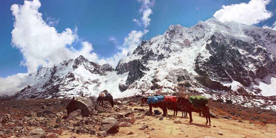
3. Technical Passages: The Salkantay Route
While much of the ancient network is now lost to time or modern development, sectors like the Salkantay remain as a testament to the route's difficulty. Crossing "El Paso" at nearly 4,600 meters (15,000 feet), the path transitions from glacial moraines to humid cloud forests. This sector showcases the transition in road-building materials, using local stone to stabilize the path against the intense erosion of the tropical rains.
4. Historical Resilience: From Empire to UNESCO Site
Following the Spanish conquest in 1533, the focus shifted from the high-mountain network to coastal logistics, leading to the foundation of Lima. However, the architectural integrity of the Inca paths allowed them to survive centuries of neglect and earthquakes. Today, the restored sectors around Cusco and Machu Picchu serve as a reminder of a time when the road was not just a convenience, but a sacred link between the sun and the earth.
Conclusion
The Inca Trails are the spiritual ancestors of every mountain road featured on this site. They remind us that the challenge of the terrain is eternal. Whether conquered by stone steps or modern 4x4 vehicles, the Andes demand respect, preparation, and an understanding of the geography that has shaped human transit for over half a millennium.