Driving the 22 highest paved roads of the Alps
The Alps are a mountain system located in south-central Europe, to the immediate north of the Mediterranean Sea. They extend for almost 700 miles in a crescent shape from the coastline of southern France (near Monaco) into Switzerland, then through northern Italy and into Austria, and down through Slovenia, Croatia, Bosnia and Herzegovina, Serbia and Montenegro - then ending in Albania on the rugged coastline of the Adriatic Sea.
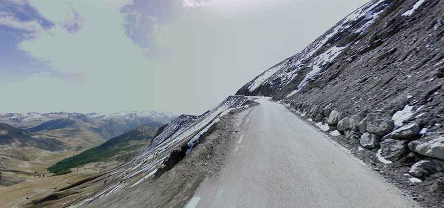
The highest point is Mont Blanc at 15,771 ft. (4,807m). The mountains were formed over hundreds of millions of years as the African and Eurasian tectonic plates collided. Join us on this expedition, delving into the engineering marvels that navigate the highest reaches of the Alps.
What are the Highest Paved Roads of the Alps?
| Mountain Pass | Country | Elevation | Route |
|---|---|---|---|
| Cime de la Bonette | F | 2802m | Jausiers to St.-Étienne-de-Tinée |
| Col de l'Iseran | F | 2770m | Val d'Isere to Lanslebourg |
| Passo dello Stelvio | I | 2757m | Schluderns/Sluderno to Bormio |
| Colle dell'Agnello | F/I | 2746m | Molines-En-Queyras to Chianale |
| Col de la Bonette | F | 2715m | Jausiers to St.-Étienne-de-Tinée |
| Col de Restefond | F | 2692m | Jausiers to St.-Étienne-de-Tinée |
| Faux Col de Restefond | F | 2656m | Jausiers to St.-Étienne-de-Tinée |
| Col de Parpaillon | F | 2645m | Condamine Châtelard to Embrun |
| Passo di Gavia | I | 2627m | Bórmio to Ponte di Legno |
| Col du Galibier | F | 2556m | Valloire to Col du Lautaret |
| Umbrailpass | CH/I | 2506m | Santa Maria to Bormio |
| Großglocknerstraße | A | 2505m | Bruck/Glocknerstraße to Heiligenblut |
| Timmelsjoch | A/I | 2479m | Obergurgl to St. Leonhard/Passeiertal |
| Colle dei Morti | I | 2480m | Colle Valcavera to Colle d'Esischie |
| Nufenenpass | CH | 2478m | Airolo to Ulrichen |
| Grand St. Bernard | CH/I | 2469m | Martigny to Aosta |
| Col de la Moutière | F | 2454m | Jausiers to St-Étienne-de-Tinée |
| Nockalmhöhenstraße | A | 2440m | Innerkrems to Ebene Reichenau |
| Furkapass | CH | 2431m | Hospental to Ulrichen |
| Col d'Izoard | F | 2360m | Arvieux to Cervières |
| Col du Mont Cenis | F | 2081m | Lanslebourg to Susa |
| Colle delle Finestre | I | 2178m | Meana di Susa to Sestriere |