Long Tom Pass is One of the Best Roads in South Africa
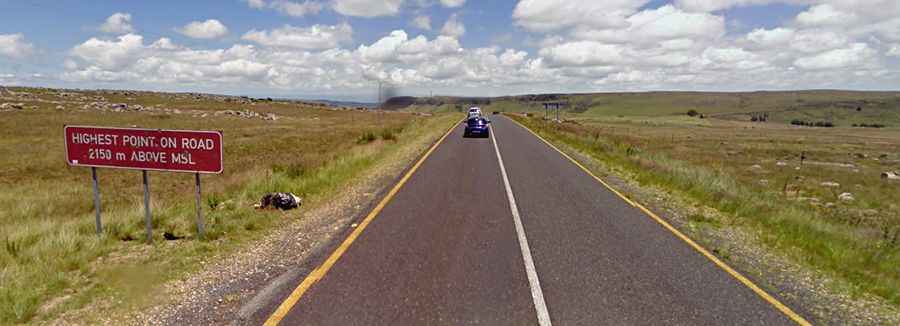
Long Tom Pass is a high mountain pass at an elevation of 2,151m (7,057ft) above sea level, located in Mpumalanga, in South Africa.
Where is Long Tom Pass?
The pass is situated in the northeastern part of the country, within the Sterkspruit Nature Reserve. A monument in the pass commemorates the final use of the Boer 155 mm Creusot Long Tom guns during the Second Boer War.
Why is it called Long Tom Pass?
The pass is named after the Long Tom cannons used during the Anglo-Boer War. It was originally a route for pioneer wagon drivers transporting goods from Mozambique to Lydenburg.
Is the road to Long Tom Pass paved?
The road to the summit is fully paved and is known as the R37. With hundreds of bends, corners, and curves, it is a beautiful route to drive. The road is now in excellent condition, offering one spectacular panoramic view after another. It handles heavy traffic, both tourist and commercial.
How long is the road to Long Tom Pass?
The pass stretches 57.2 km (35.54 miles) and runs west to east, from Lydenburg (a town in the Thaba Chweu Local Municipality) to Sabie (a forestry town on the banks of the Sabie River). Set high on the Great Escarpment, the pass is prone to heavy mist, making it dangerous in low visibility conditions.