A sensational road to Barkly Pass in the Eastern Cape
Barkly Pass is a high mountain pass at an elevation of 2.018m (6,620ft) above sea level, located in the highlands of the Eastern Cape province of South Africa.
Why is it called Barkly Pass?
The pass is named after Sir Henry Barkly, a 19th-century British colonial administrator and governor of the Cape Colony from 1870 to 1877. It has historical significance as an important route for transportation and communication in the region.
Is Barkly Pass paved?
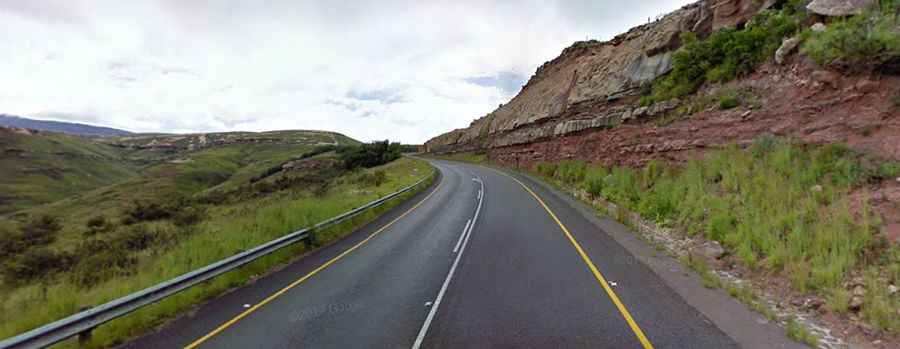
The road to the summit is fully paved and generally well-maintained. It’s called R58. It can be challenging to drive due to its steep gradients and sharp curves. Obey the speed limits, and you will be safe.
How long is Barkly Pass?
The pass is around 62 km (38 miles) long, running south-north from Elliot, also known as Khowa, to Barkly East. The pass starts a few kilometers outside Elliot at 1,473 meters above sea level and ascends moderately steep, at a gradient of 1:22, attaining an elevation gain of 626 meters over a distance of 12 km. After a few sharp hairpin bends it reaches an elevation of 2.018m at the summit.
Is Barkly Pass challenging in winter?
Set high in the southern slopes of the Drakensberg Mountains, the pass is subject to frequent winter snow closures. Extreme caution should be exercised on this pass, as there have been many fatal accidents, due to the very cold weather that can be experienced on the pass where snow and ice on the roadway during winter is common. The pass can be expected to close around the beginning of winter when the first snowfalls begin, often overnight, making the road that links Barkly East village and Elliot hazardous.