What are the most spectacular roads in South Africa?
Drivers, get ready to rev up the engine on the roads of South Africa. Tarmac, gravel, or dirt, the roads in the country have it all, from dangerous mountain passes, to coastal drives. Located at the southern tip of the African continent, South Africa covers an area of approximately 1,221,037 square kilometers. It’s bordered by Namibia, Botswana, Zimbabwe, Mozambique and Lesotho. It has a very varied climate, from arid to subtropical and rainfall patterns influenced by the Indian and Atlantic oceans.
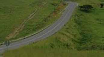
The country hosts 85 roads listed as the most spectacular in the world, and becomes a true dream for every driver. You can’t miss the road to Swartberg Pass, with switchbacks and breathtaking views at every turn, climbing up to 1.574m (5,164ft) above sea level in the Western Cape province, or the world famous Sani Pass, a hairy drive to the roof of Africa, climbing up to 2.876m (9,400ft) above sea level, on the border with Lesotho. If you prefer the seaside, Chapman’s Peak Drive is one of the world's most spectacular coastal drives, offering unparalleled scenic beauty and thrilling twists along the way. If you’re searching more defiant drives, don’t forget to check out our content about the highest roads in South Africa.
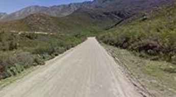
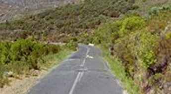
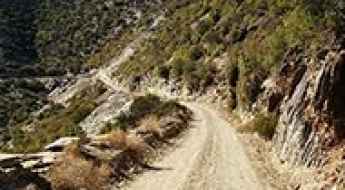
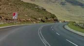
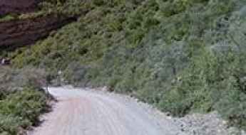
Swartberg Pass, switchbacks and breathtaking views at every turn
Swartberg Pass is a high mountain pass at an elevation of 1.574m (5,164ft) above sea level, located in the Western Cape province of South Africa.
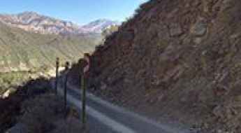
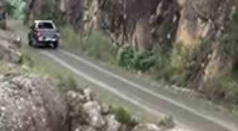
Sani Pass is a hairy drive to the roof of Africa
Sani Pass is an international high mountain pass at an elevation of 2.876m (9,400ft) above sea level, located on the border of South Africa and Lesotho. It’s one of the highest roads in the country.
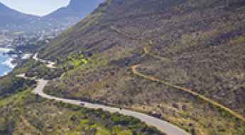
Chapman’s Peak Drive is one of the world's most spectacular coastal drives
Located on South Africa's Atlantic Coast, Chapman’s Peak Drive ranks among the world's most breathtaking coastal drives, offering unparalleled scenic beauty and thrilling twists along the way.
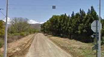
Driving Die Hel, South Africa's Road To Hell
Die Hel is a valley located in the Western Cape Province, on the southwestern coast of South Africa. The road to Die Hel is rather dangerous.
Bainskloof Pass is a drive worth taking in SA
Bainskloof Pass is a mountain pass at an elevation of 597m (1,958ft) above sea level, located in the Western Cape province of South Africa. It’s said to be one of South Africa’s finest scenic passes.
A journey on the legendary Montagu Pass of SA
Montagu Pass is a mountain pass at an elevation of 741m (2,431ft) above sea level, situated in the Western Cape province of South Africa.
Travel guide to the top of Prince Alfred Pass in SA
Prince Alfred's Pass is a mountain pass at an elevation of 1,040m (3,412ft) above sea level, located in South Africa.
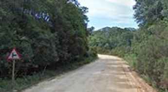
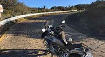
Eselbank Pass in SA: 4x4 vehicles only
Eselbank Pass is a high mountain pass at an elevation of 978m (3,208ft) above sea level located in the Western Cape province of South Africa. This route is not recommended for normal cars.
What are the highest roads in South Africa?
Located on the southernmost tip of the African continent, South Africa is one of the world's most geographically varied and topographically dramatic nations. Its interior is dominated by a massive, high-altitude plateau which drops abruptly to the coast via the Great Escarpment. This monumental geological feature, crowned by the ancient, beautiful peaks of the Drakensberg Mountains, creates some of the most impressive mountainous terrain on the continent.
A memorable road trip to Rooiberg Pass in SA
Rooiberg Pass is a mountain pass at an elevation of 798m (2,618ft) above sea level, located in the Western Cape Province of South Africa.
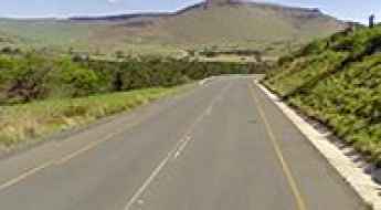
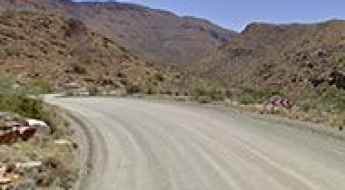
A challenging drive to Naude's Neck Pass in SA
Naude's Neck Pass is a high mountain pass at an elevation of 2.592m (8,503ft) above sea level, located in the Eastern Cape province of South Africa. This pass is not for the faint-hearted, and even in full 4WD, vehicles can slide around on the muddy surfaces. It’s one of the highest roads of South Africa.
A dangerous paved road to Van Reenen's Pass in South Africa
Van Reenen's Pass is a high mountain pass at an elevation of 1.777m (5,830ft) above sea level, located in the Free State province of South Africa. This pass produces a fair portion of South Africa’s trucking accidents.
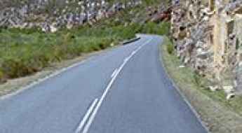
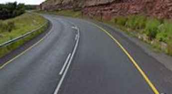
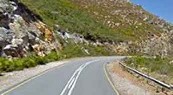
A scenic paved road to Tradouw Pass in South Africa
Tradouw Pass is a mountain pass at an elevation of 352m (1,154ft) above sea level, located in the Western Cape Province in South Africa. It is truly one of those mountain passes that you must drive.
De Beer's Pass is one of the most dangerous roads of South Africa
De Beer's Pass is a high mountain pass at an elevation of 1,722m (5,649ft) above sea level, located in the KwaZulu-Natal province of South Africa. This is considered one of the most dangerous roads in the country and has been the site of a number of fatal accidents.
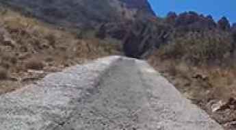
A fairly extreme road for experienced drivers to Carlisleshoek Pass
Carlisleshoek Pass is a high mountain pass at an elevation of 2.563m (8,408ft) above sea level, located in the Eastern Cape province of South Africa. You don't need 4x4, but you do need controlled power, particularly where the cement strips zigzag their way up the most extreme section. It’s one of the highest roads of South Africa.
Adventure along Bosluiskloof Pass in SA
Bosluiskloof Pass is a mountain pass at an elevation of 1.124m (3,687ft) above sea level, located in the Western Cape province of South Africa. Focused attention by drivers required.
Outeniqua Pass offers spectacular views changing at every corner
Outeniqua Pass is a mountain pass at an elevation of 800m (2,600ft) above sea level, located in the Western Cape province of South Africa.
Lootsberg Pass is the highest road in the Karoo
Lootsberg Pass is a high mountain pass at an elevation of 1.781m (5,843ft) above sea level, located in the Eastern Cape province of South Africa.
Biggest altitude gain ranking of 500 South African passes
South Africa is a country renowned for its varied topography and occupies the southern tip of the African continent.
Travel Guide to Joubert's Pass in the Witteberg Mountains
Joubert's Pass is a high mountain pass at an elevation of 2,234m (7,329ft) above sea level, located in the Eastern Cape province of South Africa, near the border with Lesotho.
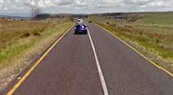
A sensational road to Barkly Pass in the Eastern Cape
Barkly Pass is a high mountain pass at an elevation of 2.018m (6,620ft) above sea level, located in the highlands of the Eastern Cape province of South Africa.
A sensational road to Cala Pass in Eastern Cape
Cala Pass is a high mountain pass at an elevation of 1.517m (4,977ft) above sea level, located in the Eastern Cape province of South Africa.
Long Tom Pass is One of the Best Roads in South Africa
Long Tom Pass is a high mountain pass at an elevation of 2,151m (7,057ft) above sea level, located in Mpumalanga, in South Africa.
Driving the Paved Scenic Road to Garcia's Pass
Garcia's Pass is a mountain pass at an elevation of 548m (1,797ft) above sea level, located in the Western Cape Province of South Africa.
A Steep Unpaved Road to Hela Hela Pass in KwaZulu-Natal
Hela Hela Pass is a mountain pass at an elevation of 1,199m (3,934ft) above sea level, located in the KwaZulu-Natal province of South Africa.
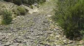
Dare to drive the gravel 4x4 road to Volunteershoek Pass
Volunteershoek Pass is a high mountain pass at an elevation of 2,567m (8421 ft) above sea level, located in Eastern Cape, South Africa. This is strictly a 4x4 only route. It’s one of the highest roads in the country.
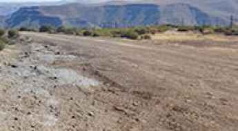
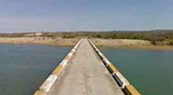
Driving the unpaved road to Misverstand Dam in the Western Cape
Misverstand Dam is a combined gravity and arch-type dam located in the Swartland region of South Africa. It’s a perfect place for any water enthusiast.
A Scenic Paved Road to Katbakkies Pass
Katbakkies Pass is a mountain pass at an elevation of 1,198 meters (3,930 feet) above sea level, located in the Western Cape province of South Africa.
If you love to drive, you will love the road to Penhoek Pass
Penhoek Pass is a high mountain pass at an elevation of 1,852 m (6,076 ft) above sea level, located in the Eastern Cape province of South Africa.
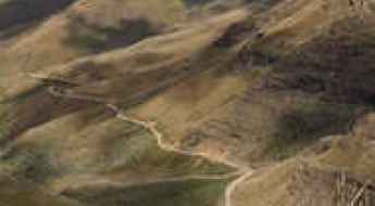
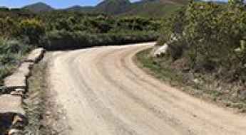
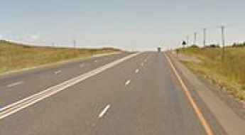
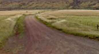
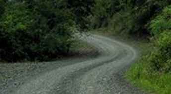
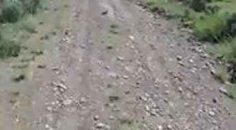
Adventure Along the R332 Road in Eastern Cape
Located in the heart of the Eastern Cape province of South Africa, driving the R332 Road is a true adventure. Mostly a single-lane gravel road, the area is beautiful, but you must drive slowly and carefully. A 4x4 is recommended for this route.
The Ultimate Guide to Traveling the Mike's Pass
Mike's Pass is a high mountain pass at an elevation of 1,931m (6,335ft) above sea level, located in KwaZulu-Natal, South Africa. Private vehicles are no longer permitted on the pass.
Courage Is Required to Drive to the Summit of Matroosberg Peak
Matroosberg is a high mountain peak at an elevation of 2,249 m (7,378 ft) above sea level, located in the Western Cape Province of South Africa.
Otto Du Plessis Pass is one of the most beautiful mountain roads in the Eastern Cape
Otto Du Plessis Pass is a high mountain pass at an elevation of 2,115m (6,938ft) above sea level, located in the Eastern Cape province of South Africa. The pass has all the elements of a classic gravel road: intrigue, danger, stunning views, and technical driving.
The Road to Swaershoek Pass is Suitable for All Vehicles in Fair Weather
Swaershoek Pass is a high mountain pass at an elevation of 1,981m (6,499ft) above sea level, located in the Eastern Cape province of South Africa.
The Road to Molteno Pass, South Africa's First Mountain Pass
Molteno Pass is a mountain pass at an elevation of 1,204 m (3,950 ft) above sea level, straddling the Western Cape and Northern Cape provinces of South Africa.
Adventure Along The Wild Road to Platberg in Harrismith
Platberg is a high mountain peak at an elevation of 2,394m (7,854ft) above sea level, located in the Free State province of South Africa. It’s a 4x4 track with concreted strips.
Adventure along the Old Mill Drift 4x4 in the Free State
Old Mill Drift 4x4 is an amazing drive located in the Free State of South Africa. The trail requires a 4WD vehicle with low range and good ground clearance.
Driving the Steep Road to Mariepskop
Mariepskop is a high mountain peak at an elevation of 1,942m (6,371ft) above sea level, located in South Africa. It’s one of the greatest drives in the country. Driving up the mountain is not for the faint-hearted or learner drivers.
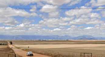
Crossing the narrow Gourits River Bridge
Located in the Southern Cape of South Africa, the Gourits River Bridge is 131.88 m long. It’s one of the most spectacular bridges in the world.