A dangerous road to Tsaris-Hoogte Pass
Tsaris-Hoogte Pass is a high mountain pass at an elevation of 1.672m (5,485ft) above sea level, located in Hardap region, in Namibia. It’s one of the highest roads in the country.
Where is Tsaris-Hoogte Pass?
The pass, also known as Tsaris Pass, Zarishoogte Pass and Zarishoogtepass, is located in the central part of the country, in the Tsaris Mountains.
Is Tsaris-Hoogte Pass unpaved?
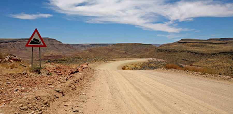
The road to the summit is fully unpaved. It’s called C19. This track can get very muddy and slippery after rain making it challenging to get through. Corrugated sections are quite common. The road is pretty steep, with an average gradient of 6% but over the 20% in parts. It is a beautiful scenery and really something for the avid adventurer who loves nature.
How long is Tsaris-Hoogte Pass?
The pass is 150 km (93 miles) long, running from Sesriem, a small settlement in the Namib Desert to Maltahöhe, a village in the Hardap Region. A 4x4 vehicle is required. The drive is dangerous if not driven with extreme caution.
Pic: Walter Waldis