What are the most spectacular roads in Mozambique?
Located in the southern part of Africa, driving the most spectacular roads of Mozambique is a wild experience for any driver. Covering an area of 801,590 km2 (309,500 sq mi), Mozambique is approximately the size of New South Wales in Australia. The country has a tropical climate with two seasons: wet (from October to March) and dry (from April to September). Due to the rainfalls, the country faces evident transportation problems during the rainy season.
The country is home to many interesting roads, with Estrada Nacional 13 being a very remarkable drive. It’s also worth driving the scenic yet unpaved road to Poelela Lake, a lake with turquoise waters, is located in the province of Inhambane. And we can’t forget the historic Mozambique Island Bridge, a historically significant concrete bridge built in 1967 and linking the Mozambican mainland and Mozambique Island.
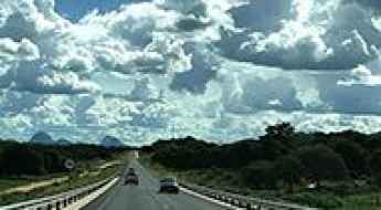
How to drive Estrada Nacional 13 in Mozambique?
Located in the northern part of Mozambique, Estrada Nacional 13 (EN13) is a very challenging drive.
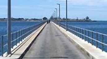
The historic Mozambique Island Bridge
Mozambique Island Bridge is a historically significant concrete bridge linking the Mozambican mainland and "Ilha de Moçambique" (Mozambique Island). It’s one of the most spectacular bridges in the world.
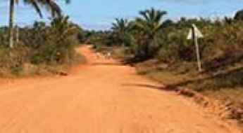
How to get by car to Poelela Lake in southern Mozambique?
Lagoa Poelela is a large inland freshwater lake with turquoise waters located in the district of Inharrime, in Mozambique.
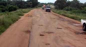
Driving on One of the Worst Roads in Mozambique from Inchope to Gorongosa
Straddling Manica and Sofala provinces of Mozambique, the road from Inchope to Gorongosa is said to be one of the worst in the country.