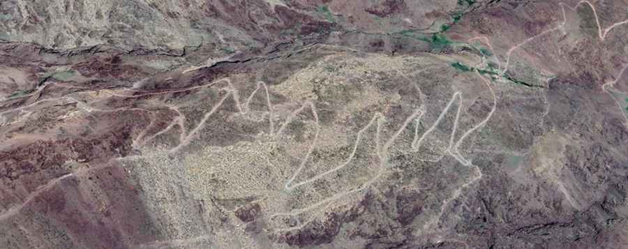
How to drive the 44 hairpin turns to Jbel Tagdalt?
Jbel Tagdalt is a high mountain peak at an elevation of 3.246m (10,649ft) above sea level, located in Morocco. It’s one of the highest roads of the country.
Where is Jbel Tagdalt?
The peak is located on the boundary between the Marrakesh-Safi and Drâa-Tafilalet regions, in the central part of the country.
Is the road to Jbel Tagdalt unpaved?
The road to the summit is totally unpaved. 4x4 vehicle required. It’s not an easy drive, with narrow parts and steep sections. It features many dangerous drops and 44 hairpin turns.
How long is the road to Jbel Tagdalt?
Starting from Tizi N'Tichka, the road to the summit is 13.7 km long. Over this distance, the elevation gain is 1174 m and the average gradient is 8.56%.
Is the road to Jbel Tagdalt open year-round?
Set high in the High Atlas mountains, the road is totally blocked in winters due to the heavy snowfalls in the area.