How to drive the paved N29 road to Tizi Bouzabel?
Tizi Bouzabel is the highest point of this Middle Atlas sector, reaching 2,267m (7,437ft). To get there, you navigate the Boulemane province on the N29, a road that forces you to stay sharp every second. It’s the logistical ceiling of the 53 km route between Talzemt and Tmourghout.
| Road facts: Tizi Bouzabel | |
|---|---|
| Location | Boulemane, Middle Atlas, Morocco |
| Elevation | 2,267 m (7,437 ft) |
| Road | N29 (Paved) |
| Technical Hazard | Black ice and crumbling shoulders |
How is the real-world driving on the N29 climb to Tizi Bouzabel?
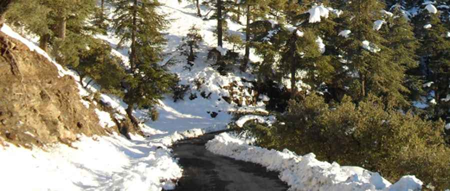
The asphalt on the N29 is badly damaged in several sections. Even though it is paved, the road is narrow and the shoulders often crumble away toward the drops. If you drive here in winter, watch out for the shaded cedar forest patches: black ice is invisible and the car will slide without warning. Don't push your speed; the hairpins are tight and there are zero safety barriers. You’ll need to use low gears to avoid overheating the engine on the way up and to keep from frying your brake pads on the long descent back to the valley.
Is Tizi Bouzabel passable during heavy snow?
At 2,267m, the snow is a serious logistical factor. While the N29 is a national road and snowplows usually clear it, you can easily get stranded without chains or a proper 4x4. Driving at night is a gamble: there’s no lighting and you’ll likely find sheep or cattle standing in the middle of the road around every bend. If your passengers are prone to car sickness, get ready; it’s 53 km of constant twisting with not a single straight stretch to catch your breath.
Pic: rachid elkhattabi