Jebel Ouamenzri: Driving the high R704 road to Agoudal
Reaching an elevation of 2,583m (8,474ft) above sea level, Jebel Ouamenzri is a high mountain pass located in the Tinghir Province of central Morocco. Situated in the heart of the Drâa-Tafilalet region, this crossing is one of the highest and most spectacular points along the legendary R704 road, linking the Dadès Valley with the high-altitude plateau of Agoudal.
| Road facts: Jebel Ouamenzri | |
|---|---|
| Location | Tinghir Province, Morocco |
| Elevation | 2,583 m (8,474 ft) |
| Distance | 122 km (76 miles) |
| Surface | Asphalt and Gravel (Piste) |
| Route | Boumalne Dades to Agoudal |
Is the road to Jebel Ouamenzri paved?
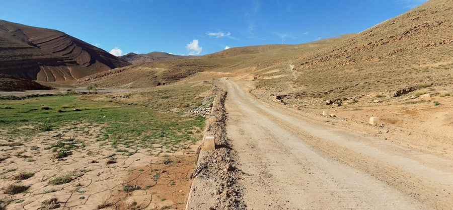
The road follows a dual nature. Starting from Boumalne Dades, the first section is paved as it winds through the famous Dadès Gorges. However, as you climb higher toward the Jebel Ouamenzri summit, the asphalt disappears. The route becomes a challenging dirt and gravel track (piste). The surface is often hard-packed but covered with loose, sweeping gravel that makes traction difficult on the steep inclines. There are no guardrails, and the road features extreme drop-offs that require absolute concentration from the driver.
How long is the R704 road to Agoudal?
The entire journey from south to north, between Boumalne Dades and Agoudal, spans 122 km (76 miles). While the paved section is relatively fast, the unpaved portion over the pass is slow and arduous. Expect to spend several hours on this route due to the technical nature of the hairpins and the high elevation. It is a remote drive where assistance is difficult to find; you must be self-sufficient and ensure your vehicle is in top mechanical condition before leaving the valley floor.
What are the main hazards when driving to Jebel Ouamenzri?
The primary dangers are the unprotected steep edges and the unstable road surface. Sharp rocks on the track are notorious for causing tire punctures, so carrying at least one full-size spare is mandatory. During the winter, although the road is technically open year-round, short-term closures due to heavy snowfalls are common at 2,500 meters. After a storm, the track can become extremely slippery and muddy, making it dangerous even for 4x4 vehicles. Flash floods in the lower gorges during the rainy season can also wash out sections of the road without warning.
What supplies do I need for the High Atlas crossing?
Isolation is total once you leave the tourist areas of the Dadès Gorges. There are no gas stations or workshops between the main settlements of Boumalne Dades and Agoudal. You should start the 122 km trip with a full tank of fuel and carry extra water and food. Because of the high altitude, temperatures can drop significantly even in summer, so warm clothing is essential. A high-clearance vehicle is highly recommended to navigate the rocky washouts and uneven "piste" sections near the summit of Jebel Ouamenzri.
Pic: Mike Philippens