How to drive the unpaved road to Tizi n’Ait Imi?
Tizi n’Ait Imi is a high mountain pass at an elevation of 2.914m (9,560ft) above sea level, located in Morocco. It’s one of the highest roads in the country.
Where is Tizi n’Ait Imi?
The pass, also known as The Pass of the Sheep with Black Eyes, is located on the boundary between Béni Mellal-Khénifra and Drâa-Tafilalet regions, in the central part of the country.
How long is Tizi n’Ait Imi?
The road through the pass is 61.4 km (38.15 miles) long, running north-south from Tabant, (a small town in Azilal Province, Béni Mellal-Khénifra) to Ighil N'Oumgoun (in the Ouarzazate Province of the Souss-Massa-Drâa administrative region).
Is Tizi n’Ait Imi unpaved?
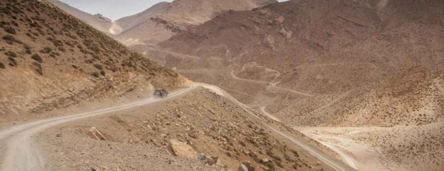
The road to the summit is totally unpaved. It was built in 2015-2016. A high-clearance vehicle is recommended. After rains the road can be very tricky because of mud.
Is Tizi n’Ait Imi open in winters?
Set high in the Western High Atlas, the greatest mountain range of North Africa, the road is open year-round. However, it’s usually impracticable in winter due to the snow covering the road.
Pic: Jorge Ruiz Dueso www.jrdueso.es