Driving to Jbel Ayachi, one of Africa's highest roads
Jbel Ayachi is a high mountain peak at an elevation of 3.727m (12,227ft) above sea level, located in the Drâa-Tafilalet region of Morocco. It’s one of the highest roads of the country.
Why is Jbel Ayachi famous?
Set high in the central part of the country, in the Eastern High Atlas, the peak, also known as Djebel Ayachi, is one of the highest mountains in North Africa. The views from the summit are stunning, dominating the far east of the Atlas. At the summit, a huge cone is installed to mark the climb, with panoramic views, extending for miles across the landscapes of the eastern High Atlas, including the Cirque de Jaffar.
Can you drive to Jbel Ayachi?
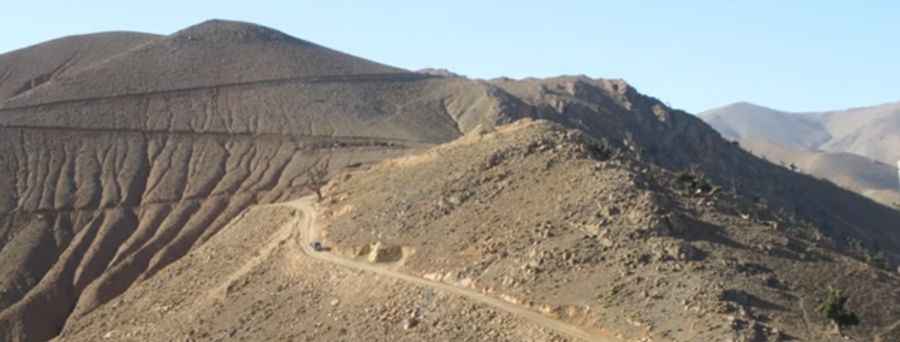
In 2015, a road was built to the summit to allow the construction of some mountain resorts at the top. The road is totally unpaved and not suitable for regular cars. It is currently impassable by 4x4, but it might be possible with a dirt bike. There are mudslides and rock slides that block the road about a third of the way up. The final part of the road is impassable without an excavator. Furthermore, it’s almost impossible to find it. It can only be found by following the line on satellite images. It’s one of the highest roads of Africa.
How long is the road to Jbel Ayachi?
Starting from Zaouiet Sidi Hamza, the road is 29.7 km (18.45 miles) long. Over this distance, the elevation gain is 2,477m with an average gradient of 8.34%.
Is the road to Jbel Ayachi open in winter?
Snow remains on the peak until late May or early June, and the peak stays snow-covered and cold late into the year.
Pic&Video: نبض اقليم ميدلت
Road suggested by: Jason Corkill