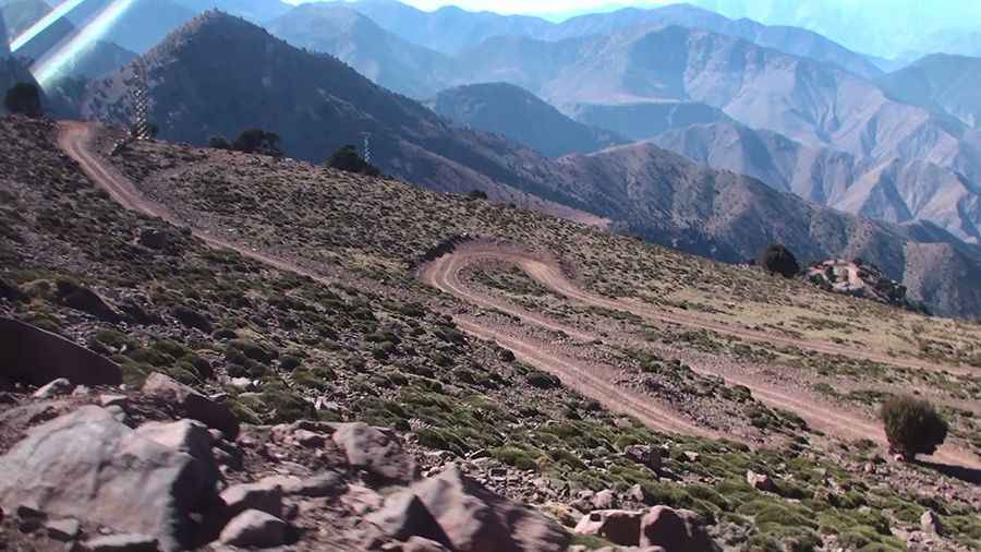
Road from Oussertek to Oukaimeden: 24 Hairpins in the High Atlas
Located in the Al Haouz Province of Morocco, the road connecting Oussertek and Oukaimeden is a high-altitude mountain track. Reaching an elevation of 2,690m (8,825ft) above sea level, it is categorized as one of the highest roads of the country, providing a direct but technically demanding link through the High Atlas range.
| Road facts: Oussertek to Oukaimeden | |
|---|---|
| Location | Al Haouz Province, Morocco |
| Elevation | 2,690 m (8,825 ft) |
| Length | 7 km (4.34 miles) |
| Max Gradient | 12% |
| Hairpin Turns | 24 |
How is the road from Oussertek to Oukaimeden?
The road is 7 km (4.34 miles) long, running west-east between Oussertek and the Oukaimeden ski resort. The track is entirely unpaved, consisting of loose rock and compacted red clay typical of the Atlas region. Due to the extreme terrain, a high-clearance 4x4 vehicle is mandatory. The drive is defined by its intensity, featuring 24 sharp hairpin turns packed into a short distance, with several ramps reaching a maximum gradient of 12%.
Driving hazards and technical requirements
The primary hazard is the lack of lateral protection on a narrow shelf road. The surface is highly sensitive to weather conditions; during the winter months, heavy snowfall makes the track impassable and extremely slippery. In the dry season, the main challenge is the loose surface traction on the steep 12% inclines, where tires can easily lose grip on the tightest turns. The road is narrow, often limited to a single lane, requiring drivers to anticipate oncoming traffic and be prepared for high-precision maneuvering on the 24 switchbacks.
Logistics and Seasonal Access
At nearly 2,700 meters, the thin air causes a reduction in engine power, which must be compensated for with low-range gearing. There are no services, safety barriers, or mechanical assistance points along the 7 km stretch. While the track offers an alternative route to the Oukaimeden area, it is strictly for experienced mountain drivers. During the spring melt, the red clay becomes saturated and prone to minor landslides, which can narrow the already constrained path or deposit large stones on the track.
Operational Strategy
Navigating this sector requires constant attention to the cooling system and brake temperature. On the descent toward Oussertek, engine braking is essential to manage the 12% slopes without fading the braking system. It is recommended to travel during daylight hours, as the track has no lighting and the irregular rock edges become invisible after dusk. Drivers should also monitor the sky for rapid convective cloud development, as flash floods in the High Atlas can wash out sections of the unpaved surface in a matter of minutes.
Pic: Peter Jongen