Tizi n’Taroubia: A steep 4x4 climb in the Moroccan Atlas
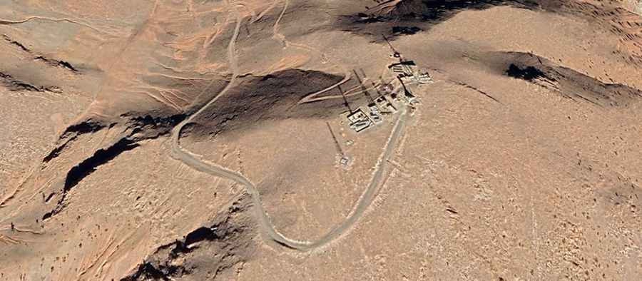
Tizi n’Taroubia is a high-altitude mountain peak that serves as a technical boundary between the Errachidia and Khénifra provinces in Morocco. Reaching an elevation of 2,339m (7,673ft) above sea level, the track to the summit is a brutal 4.9-kilometer climb characterized by steep gradients and an unforgiving unpaved surface. Situated between the Middle and High Atlas ranges, this road is less of a transit route and more of a service track for the high-altitude communication towers that dominate the peak.
| Road facts: Tizi n’Taroubia | |
|---|---|
| Location | Atlas Mountains, Morocco (Errachidia / Khénifra) |
| Max Elevation | 2,339m (7,673ft) |
| Length | 4.9 km (3 miles) |
| Average Gradient | 9.10% |
How challenging is the climb from Tizi N´Talghaumt to Tizi n’Taroubia?
The ascent to Tizi n’Taroubia begins near the well-known Tizi N´Talghaumt pass. Over a short distance of 4.9 kilometers, the road gains 446 meters of elevation, maintaining a sustained average gradient of 9.10%. This is an intense vertical push that requires a 4x4 vehicle with high ground clearance. The challenge here is the lack of grip; the track consists of loose shale and sun-baked earth that can easily cause wheel spin on the steeper hairpins. Navigating this climb is an exercise in managing engine torque, as the thin air at 2,300 meters reduces the power available to tackle the most aggressive ramps.
Why is weather a critical factor on the road to Tizi n’Taroubia?
Despite its location in the central part of Morocco, the Tizi n’Taroubia is a high-mountain environment where the weather is a permanent threat. During the winter months, the track can become completely impassable due to heavy snowfall that remains on the shaded north-facing slopes. Even in the shoulder seasons, a sudden storm can turn the dusty track into a lethal mud slide, making the descent incredibly dangerous due to the total absence of safety barriers. Before attempting the drive, checking the regional forecast is mandatory, as the technical nature of the unpaved surface leaves zero margin for error during a flash flood or a snow squall.
What are the hazards of the communication tower service road?
The track was primarily designed to provide access to the communication towers at the summit of Tizi n’Taroubia. Because of this, the road is maintained only for heavy-duty service vehicles and is not intended for standard civilian use. The surface is often rutted by the passage of maintenance trucks, and large rocks frequently tumble onto the path from the weathered slopes. Driving here requires constant vigilance for obstacles that can tear a tire sidewall or damage the vehicle’s undercarriage. It is a dead-end road that demands a slow, calculated pace, where reversing in a tight spot might be your only option if the road ahead is blocked by a recent rockfall.
Is a 4x4 mandatory for the Tizi n’Taroubia summit?
Attempting the Tizi n’Taroubia in a two-wheel-drive vehicle is a recipe for mechanical failure. The combination of the 9.10% gradient and the loose mountain debris makes it impossible to maintain traction without a low-range gearbox and off-road tires. The ascent puts massive thermal stress on the cooling system, and the descent is a test for the brakes, which must be managed through engine braking to prevent fading on the steep, unprotected hairpins. This is a journey through the raw, industrial heart of the Atlas, where the only guarantee of a safe return is the mechanical integrity of your vehicle and your ability to drive on a deteriorating mountain ledge.