Driving The Escarpment Road through Ethiopia's Blue Nile Gorge
Located on the boundary between the Amhara and Oromiya regions in Northern Ethiopia, the Blue Nile Gorge is one of the world's largest gorges. Situated in the Ethiopian highlands and part of the northern Ethiopia plateau, it plunges to a depth of approximately 1,500m (4,900ft).
How long is The Escarpment Road?
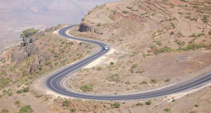
The gorge features the Escarpment Road (Road A3), a 50.4 km (31.31 miles) mostly paved road, running from Tik Giyorgis Bete Kiristyan to Gohatsion. This road, set high in the Ethiopian mountains and located 225 km north of Addis Ababa, is known for its dramatic scenery, offering stunning views at every turn.
How challenging is The Escarpment Road?
Traversing this gorge isn't just about the views; the road itself is challenging even for experienced travelers. It features sharp turns, steep gradients hitting a maximum of 15%, and sections with potholes. Descending requires full concentration, as you’ll have to drive hairpin bends avoiding deep potholes.
Architectural Feats within the Gorge
Two notable bridges span the river within the gorge. A newer Japanese suspension bridge handles traffic, while the original Italian bridge now serves as a pathway for shepherds.
Pic: bwp_2001