Mount Bwahit is one of the highest drivable roads in Africa
Mount Bwahit is a high mountain peak at an elevation of 4,437m (14,557ft) above sea level, located in the Semien Gondar Zone of the Amhara Region of Ethiopia. A road leading to some meters above the summit, is one of the highest roads in Africa.
Where is Mount Bwahit?
The peak, also known as Buahit, Bachit, and Buiheat, is located in the northern part of the country, in the Semien Mountains on Top of the Bwahit plateau.
Can you drive to Mount Bwahit?
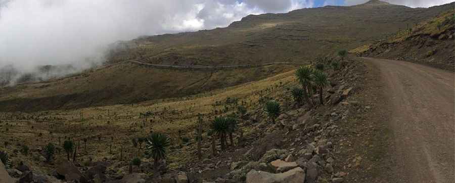
A gravel road, located to the west of the summit, was constructed in 2000. Surrounded by frozen streams, thin air and giant lobelias, driving along this road is an absolute end-of-the-world feeling. 4x4 vehicles only.
How long is the road to Mount Bwahit?
The road is 95.1 km (59 miles) long, running west-east from Debarq, also spelled Dabareq and Debark, to Mekane Berhan.
Pic: Rememberluke (https://www.wikiloc.com/mountain-biking-trails/mount-bwahit-uphill-11557674/photo-7042951)