How to get by car to Pico do Fogo?
Pico do Fogo is an active stratovolcano located on Ilha do Fogo, one of the southernmost islands in Cape Verde.
What’s Pico do Fogo?
Pico do Fogo is an active stratovolcano and the highest point in its region, reaching 2,829 meters (9,281 feet). It has a large caldera with small communities living inside, cultivating crops such as vineyards that produce local wine.
The volcano is frequently active, with eruptions in 1951, 1995, and 2014–2015, mainly producing lava flows that can be destructive to settlements within the caldera. Despite the risks, residents maintain their communities due to fertile volcanic soil and strong cultural ties.
The area is part of a protected natural park, featuring unique biodiversity and offering popular hiking opportunities, with ascents to the volcanic cone providing panoramic views and dramatic volcanic landscapes.
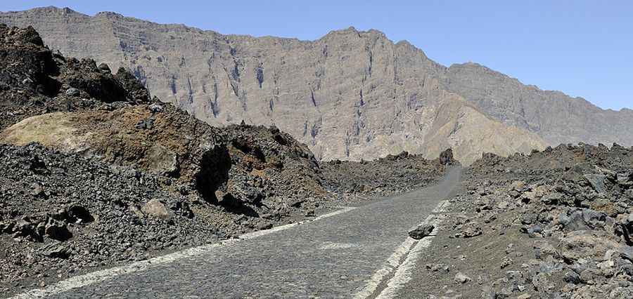
Is the road to Pico do Fogo paved?
Located in Santa Catarina do Fogo, in the northern part of the island, within the Fogo National Park (a hotspot volcanic area), a paved road climbs up to 1,815 m (5,954 ft) above sea level, on the western part of the volcano at the edge of the caldera.
How long is the road to Pico do Fogo?
The road is 20.5 km (12.73 miles) long, starting from Achada Fuma. It has steep parts and countless turns. It’s a very scenic drive.
Pic: By Cayambe [CC BY-SA 3.0 (https://creativecommons.org/licenses/by-sa/3.0)], from Wikimedia Commons