How to drive to Tikjda Pass in northern Algeria
Tikjda Pass is a mountain pass at an elevation of 1.462m (4,796ft) above sea level, located in the province of Bouïra, in Algeria.
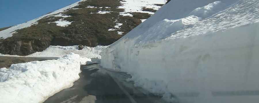
Is Tikjda Pass paved?
Set high in the Djurdjura Mountains, the road to the summit is totally paved. It’s called N33.
How long is Tikjda Pass?
The road is 23.0km (14.29 miles) long running west-east from Slim to Tizi-n-Kouilal. The road is not easy, with narrow parts and dangerous drop offs.
Is Tikjda Pass worth it?
Tucked away in the northern part of the country, the summit hosts a ski resort. The area around Tikjda is beautiful, with many peaks and hillsides covered with cedar forests. Tikjda offers many short excursions, with places like Point de vue du Djurdjura and Gouffre de l’Akouker. From the latter, virtually all of the Kabylia as well as the Mediterranean Sea can be spotted on clear days. If all this wasn’t enough, a small glacier can be found 3-4 km from Tikjda, the Takouatz Guerisséne. Around 10 km to the west of Tikjda, the lake of Goulmin is found, a sight worth this detour over and over again. The four-season resort of Tikjda offers local and international visitors the opportunity to enjoy snow sports in the winter and a variety of activities in the summer months. Whereas Tikjda was at one time inaccessible due to unrest and terrorist activities, this now peaceful resort welcomes visitors to enjoy the natural beauty and tranquility of the surroundings.
Pic: Sami Simon