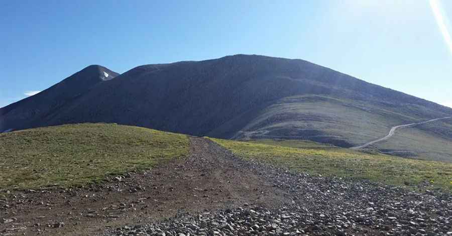
Mount Antero in Colorado is one of the highest roads of North America
Mount Antero is a high mountain peak located in Chaffee County, in the U.S. state of Colorado. A rocky, rough road with a dramatic set of switchbacks ascends to the southwest of the summit, at 4,189m (13,743ft) above sea level. It's one of the highest roads in the USA.
Where is Mount Antero Colorado?
The peak is set high in the southern Sawatch Range of the Rocky Mountains of North America, between the towns of Buena Vista and Salida, within the San Isabel National Forest. The peak is named after Chief Antero of the Uintah band of Utes.
Can you drive up Mt. Antero in Colorado?
The road to the summit is rocky, rough, and requires four-wheel drive. It’s called Baldwin Gulch Road (County Road 277). Starting at Chalk Creek Drive, the road is 11.09km (6.89mi) long.
Is the road to Mount Antero dangerous?
The route is not easy. It’s an extremely narrow shelf road with tight switchbacks ascending up to the summit. Along the way, you’ll have to deal with some dangerous drop-offs. Experienced drivers only. The trail itself is fairly easy until you get very close to the top. It is a little scary, however, as you are on very narrow shelf roads for most of the trip. There are several narrow switchback shelf roads with steep drop-offs, but the road is very solid with little or no off-camber sections. Passing another vehicle is impossible in most places. The trail here is made of loose rock and some dirt areas. Only 4-wheel-drive vehicles with high clearance should attempt this road.
Is Mount Antero open?
It’s one of the highest roads in Colorado. The road to the summit is closed by heavy snow until June and sometimes even July. Often, the road contains snow until early June, so be sure to check road conditions before traveling. Always stay on marked trails as it is easy to get lost and meet wildlife if you decide to wander. Avoid being at the top or stay in your vehicle if you see lightning in the area.
When was the road to Mount Antero built?
The trail follows numerous remnants of Colorado's mining heritage. The road to the summit was built in the early 1950s by a company that hoped to mine beryl. This area is rich in gemstones, aquamarine, and semi-precious metals. It is a great place to look at and gather rocks, and make a lot of money if you're lucky. The mountain itself is prized for its gemstone deposits and has one of the highest concentrations of aquamarine in the country.
Is the road to Mount Antero worth it?
This route has heavy mining and tourist traffic in fair weather during the summer months. The summit provides a great 360-degree panorama of the Sawatch range.
Is the road to Mount Antero steep?
The road to the summit is very steep. Starting from Chalk Creek Drive, the ascent is 11.09km (6.89mi) long. Over this distance, the elevation gain is 1,312 meters. The average gradient is 11.83%.
Pic: Adam Klopp