What are the most spectacular roads in Chile?
From the dunes of the Atacama to the ice of Patagonian glaciers, Chile is a dream for road trip enthusiasts. Located in South America, the narrow and long country hosts a never-ending list of mountain passes acting as a border with other countries. It’s worth remembering the country shares borders with Argentina, Bolivia and Peru. So, prepare to conquer Agua Negra Pass, the highest road between Argentina and Chile. At an elevation of 4.774m (15,662ft) above sea level and located on the border of Argentina and Chile, it's one of the highest roads in Chile. And, don’t miss Planchon Pass in the Andes, at 2.515m (8,251ft) above sea level, on the border with Argentina.
When you travel to Chile, there are hundreds of roads that must be in your list as it hosts more than 150 roads listed on the most spectacular drives in the world. Starting on Ruta 5, part of the Panamerican Highway, that offers a glimpse of Chile's dramatic geography; Paso Internacional Los Libertadores, a series of hairpin turns on the border with Argentina, and ending at Ojos del Salado stratovolcano, the world’s highest active volcano. At 6,891m (22,608ft) above sea level, this mountain has been the scene of several records for attaining the highest altitude aboard a land vehicle. It’s one of the highest accessible points by car on Earth.

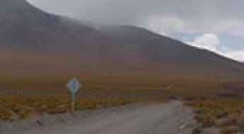
Driving to Parinacota, One of the Highest Towns in the World
Parinacota is a small town located at an elevation of 4,400 meters (14,400 feet) above sea level, in Putre, within the Parinacota Province of Chile. It’s one of the highest towns on Earth that is accessible by car.

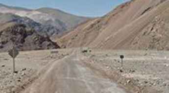
The Road to Portezuelo de Chapiquina in the Andes is Not for Timid Drivers
Portezuelo de Chapiquiña is a high mountain pass at an elevation of 4,453m (14,609ft) above sea level, located in the Arica and Parinacota Region of Chile.

Don’t glance down at your phone on the road to Uspallata Pass in the Andes
Paso Uspallata is a high mountain pass at an elevation of 3,810m (12,500ft) above sea level, located in the Valparaíso Region of Chile.

Driving the Scenic Y-620 Road to Laguna Parrillar
Y-620 is a short, unpaved mountain road in southern Chile's Magallanes and Antártica Chilena Region, leading to Laguna Parrillar.

How Can I Get by Car to Salar de Maricunga in the Atacama Region?
Salar de Maricunga is a dazzling white salt flat at an elevation of 3,700m (12,139ft) above sea level, located in the Atacama Region of Chile.

Driving the defiant Phoenix Bridge Co
The Phoenix Bridge Co is a wooden bridge located in the Araucanía Region of southern Chile. It’s one of the most spectacular bridges in the world.

The 007 Road Trip: Driving to James Bond's Futuristic Hideout at Cerro Paranal
Cerro Paranal is a high mountain peak at an elevation of 2,635m (8,645ft) above sea level, located in the Antofagasta Province of Chile.

Driving a Sensational Border Road to Icalma Pass
Paso Icalma is an international high mountain pass at an elevation of 1,307 m (4,288 ft) above sea level, located on the border of Argentina and Chile.

The Unpaved Road to Cerro Estrella in the Andes is Not for the Faint of Heart
Cerro Estrella is a high mountain peak at an elevation of 5,389m (17,680ft) above sea level, located on the Chilean-Argentinian border. It is one of the highest roads in the country.

The Road To Caldera La Pacana Has it All
Caldera La Pacana is a resurgent caldera at an elevation of 4,983m (16,348ft) above sea level, located in the Antofagasta Region of Chile. It’s one of the highest roads in the country.

Termas del Flaco
Termas del Flaco is a hot springs resort with thermal baths at an elevation of 1.776m above the sea level located in the Región del Libertador Bernardo O'Higgins, of Chile.

Cerro Chajnantor, an awe-inspiring route in the Atacama desert
Cerro Chajnantor is a high mountain peak at an elevation of 5.635m (18,487ft) above the sea level, located in the high Atacama region of Chile. It’s one of the highest roads of South America.

Travelling through Huahum Pass, one of the lowest passes of the Andes
Paso Huahum is an international mountain pass at an elevation of 625m (2,051ft) above the sea level, located in the Andes, on the border between Chile and Argentina. It’s one of the lowest passes of the southern Andes.

A paved road to Pino Hachado Pass in the Andes
Paso Pino Hachado is an international high mountain pass at an elevation of 1.887m (6,190ft) above the sea level, located on the Argentina-Chile border.

Salar de Quisquiro: The Ultimate Road Trip Guide
Salar de Quisquiro is a high mountain salt flat at an elevation of 4.210m (13,812ft) above the sea level located in the Antofagasta Region, of northern Chile. Daytime temperatures will reach up to 30 °C, while at night temperatures will tend to drop very low, even below freezing point in winter. There are often also b winds in the area.

An epic road to Abra Taapaca
Abra Taapaca is a high mountain pass at an elevation of 4.809m (15,777ft) above the sea level, located in the Nevados de Putre volcanic complex, in Chile's XV region of Tarapaca.. It's one of the highest mountain roads of Chile.

Salar de Aguas Calientes: an awe-inspiring route through extremely remote areas
Salar de Aguas Calientes is a high mountain salt flat at an elevation of 4.250m (13,943ft) above the sea level located in the Antofagasta Region, of northern Chile. Daytime temperatures will reach up to 30 °C, while at night temperatures will tend to drop very low, even below freezing point in winter. There are often also b winds in the area.

An unforgettable road to Cuesta Codoceo
Cuesta Codoceo (Portezuelo Codoceo) is a high mountain pass at an elevation of 4.342m (14,245ft) above the sea level, located in the Nevado Tres Cruces National Park in the Atacama Region of Chile.

Cerro Toco
Cerro Toco is a stratovolcano at an elevation of 5,416m (17,769ft) above the sea level located on a lunar landscape in the eastern part of the high Atacama Desert of northern Chile in the Antofagasta Region. It’sone of the highest mountain roads of Chile.

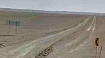
Travelling the challenging Ruta A-23
Ruta A-23 is one of the most challenging roads in the world. Located in the far northern corner of Chile, this spectacular, unpaved trail varies from smooth surfaces to stretches of washboard. It’s a 2wd road, weather permitting.

How to Drive the Road to Cerro Armazones in the Atacama Desert?
The road to Cerro Armazones is a high-altitude specialized access route located in the Antofagasta Region of northern Chile. Reaching an elevation of 3,060m (10,040ft) above sea level in the Atacama Desert, this asphalted track was engineered to facilitate the transit of massive structural components for the Extremely Large Telescope (ELT). Navigating this sector requires a vehicle prepared for extreme barometric pressure drops and sustained high-torque climbs in the driest environment on Earth.

Driving the R-264 Road: The Wooden Bridges of Nininco and Las Corrientes
Located in the Araucanía Region of southern Chile, the R-264 is a secondary gravel route known for its traditional timber engineering. The road is a key local corridor featuring some of the most spectacular bridges in the world built entirely of wood, requiring strict adherence to weight limits and vehicle dimensions.

Driving the road to Laguna de la Azufrera is not a piece of cake
Laguna de la Azufrera is a high mountain lake at an elevation of 4.288m (14,068ft) above the sea level, located in the Región de Antofagasta, in Chile.

Road B-245
B-245 is a very scenic high mountain road located in the Andes mountains of northeastern Chile. The road offers great views of volcanoes and lakes.

The breathtaking road to Cerro del Azufre
Cerro del Azufre is a stratovolcano at an elevation of 5.702m (18,707ft) above the sea level, located in El Loa Province, Antofagasta Region, Chile. It's one of the highest roads of the country.

How difficult is the high-altitude road to Cerro Pabellón in Chile?
Cerro Pabellón is an extreme high-mountain pass reaching an elevation of 4,647m (15,246ft) above sea level in the heart of the Atacama Desert. Located in the Ollagüe district of the Antofagasta region, the road was carved out specifically to provide access to the world’s highest geothermal power plant. This is a journey into the thin air of the Andean Highlands, where the mechanical limit of your vehicle and your own resistance to altitude sickness are tested on every kilometer of this dusty, sun-scorched track.
Road trip guide: Conquering Quebrada del Peñon
Quebrada del Peñon is a high mountain pass at an elevation of 3.792m (12,440ft) above the sea level, located in northern Chile’s Atacama Desert. Daytime temperatures will reach up to 30 °C, while at night temperatures will tend to drop very low, even below freezing point in winter. There are often also b winds in the area.
A paved road to Laguna Miscanti
Laguna Miscanti is a high mountain lake at an elevation of 4.120m (13,517ft) above the sea level, located in the altiplano of the Antofagasta Region, in northern Chile.

Ruta 24
Ruta 24 is a stunning drive in the Atacama Desert, one of the driest areas in the world. The road is 156km long and links Calama and Tocopilla.

Road CH-21
CH-21 is a high mountain road located in northern Chile, in Antofagasta Region. The road is mostly unpaved and runs entirely over the 2.300m above the sea level.
Portezuelo Sairécabur: Driving the 5,541m abandoned mining road in the Atacama
Reaching a staggering elevation of 5,541m (18,179ft) above sea level, Portezuelo Sairécabur is a high mountain pass located northeast of San Pedro de Atacama, on the volatile border between Chile and Bolivia. This abandoned mining path is recognized as one of the highest mountain passes in Chile and ranks among the highest mountain passes in South America, offering a brutal off-road experience through the most desolate reaches of the Andes.

Laguna del Inca o del Portillo
Laguna del Inca o del Portillo is a high mountain lake at an elevation of 2.853m (9,360ft) above the sea level, located in the high mountains of the Andes, in Valparaíso Region of Chile, close to the border with Argentina.
Cordón de Inacaliri: Driving the 5,395m mining track on the Chile-Bolivia border
Reaching a staggering elevation of 5,395m (17,700ft) above sea level, Cordón de Inacaliri is a massive volcano situated on the international border between Chile and Bolivia. Located in the heart of the Central Andes, the track to its summit is one of the highest roads in the country, originally carved as a mining access route through one of the most inhospitable environments on Earth.

Laguna de Lejia
Laguna de Legia is a high mountain lake at an elevation of 4.350m (14,271ft) above the sea level located in the Antofagasta Region of northern Chile. This is a maintained road where a high clearance 2WD vehicle is able to travel safely at low speeds on long dry straight-of-ways, without losing control due to wash boarding, ruts, or dips.
A memorable road trip to Curiquinca Volcano
Curiquinca is a stratovolcano at an elevation of 5.625m (18,454ft) above the sea level, located on the border between Bolivia and Chile. It’s one of the highest roads of the country.

Picavilque Pass, pure adventure
Abra Picavilque is a high mountain pass at an elevation of 5.085m (16,683ft) above the sea level, located near the Bolivian border, in Chile’s Region I (Tarapacá). It’s one of the highest mountain roads of the country.