What are the most spectacular roads in Bolivia?
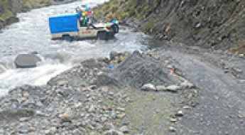
Located in South America, Bolivia is home to the most famous road in the world: the unpaved Death Road. Locally known as Carretera de los Yungas, this gravel dirt track covers a 36.4km (22.61 miles) stretch between La Paz and Coroico.
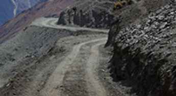
Part of the Andes Mountains (in the western part of the country), Bolivia is home to amazing mountain roads, including a few challenging mountain passes acting as a border. It’s worth driving the international Chungara-Tambo Quemado Pass, at 4.687m (15,377ft) above sea level on the border with Chile. For lovers of mountain roads, don’t miss Cerro Sairécabur, a volcano at 5.541m (18,179ft) above sea level, on the border with Chile. It’s one of the highest roads in Bolivia. Or Cerro Uturuncu, a stratovolcano in the Potosí Department, climbing up to 6.008m (19,711ft) above sea level. It’s one of the highest roads in the world. If you’re brave enough, you can tackle El Angosto, one of the deadliest roads in the world. Located in the Tarija Department, the Pilcomayo canyon ranks among the world's most treacherous roads.
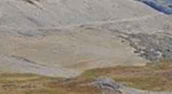
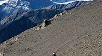
A drive to Sunchulli Pass is an otherworldly experience
Sunchulli Pass is a high mountain pass at an elevation of 5,034m (16,515ft) above sea level, located in the La Paz Department, Bolivia. It’s one of the highest roads in the country.
Driving the road to Katantika Pass in La Paz is for brave drivers only
Paso Katantika is a high mountain pass at an elevation of 4,717m (15,475ft) above sea level, located in the Franz Tamayo Province of Bolivia.
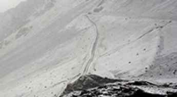
Driving the unpaved Illampu Circuit through Abra de la Calzada in the Andes
Abra de la Calzada is a high mountain pass at an elevation of 5,062m (16,607ft) above sea level, located in Larecaja Province of Bolivia. It’s one of the highest roads in the country.
Driving the remote Sarani Pass in the Bolivian Andes
Sarani Pass is a high-altitude mountain pass located at an elevation of 4,522m (14,835ft) above sea level, in the Larecaja Province of Bolivia.
How to get by car to Cumbre Chuchu in the Andes?
Cumbre Chuchu is a high mountain pass at an elevation of 4,653m (15,265ft) above sea level, located in the La Paz Department of Bolivia.
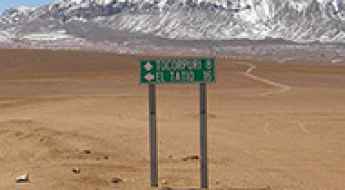
How to get by car to Tocorpuri Volcano on the border of Chile and Bolivia?
Volcán Tocorpuri is a dormant stratovolcano located on the border between Chile and Bolivia. North of the summit, a mining road climbs up to 5,563 m (18,251 ft) above sea level. It’s one of the highest roads in the country.
How to drive the unpaved road to Rhity Apacheta Pass in La Paz Department?
Paso Rhity Apacheta is a high mountain pass at an elevation of 4,874m (15,990ft) above sea level, located in La Paz Department, in Bolivia. It’s one of the highest roads in the country.
Driving the remote 4x4 road to Pura Pura Pass in La Paz Department
Paso Pura Pura is a high mountain pass at an elevation of 4,669m (15,318ft) above sea level, located in La Paz Department, in Bolivia.
Driving to Abra Wallatani: One of the highest mining roads in Bolivia
Abra Wallatani is an extreme mountain pass reaching a staggering elevation of 5,233m (17,168ft) above sea level, located in the La Paz Department of Bolivia. It stands as one of the highest roads in the country, situated in the Inquisivi Province, just below the towering peak of Wallatani and west of the town of Quime.

Reaching the Sky on the Winding Road to Alto Pacuni in the La Paz Department
Alto Pacuni is a high mountain pass at an elevation of 4,900m (16,076 ft) above sea level, located in the La Paz Department in Bolivia. It’s one of the highest roads in the country.
How to drive the remote 4x4 route to Abra Mallachuma?
Abra Mallachuma is a high-altitude mountain pass rising to 5,131m (16,833ft) above sea level, situated in the La Paz Department of Bolivia. It’s one of the highest roads in the country.
How to drive the wild 4x4 road to Abra Turi Turini?
Abra Turi Turini is a high mountain pass at an elevation of 4,985m (16,354ft) above sea level, located in the La Paz Department in Bolivia. It’s one of the highest roads in the country.
Driving an unpaved mining road to Abra Qillwa Quta in the Andes
Abra Qillwa Quta is a high mountain pass at an elevation of 4,940 m (16,207 ft) above sea level, located in La Paz Department, in Bolivia. It’s one of the highest roads in the country.
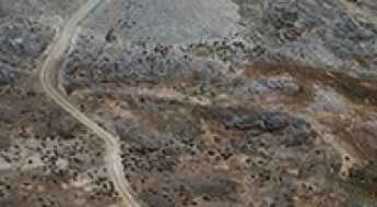
How to drive the unpaved Paso Osipal in the Apolobamba Range?
Paso Osipal is a high mountain pass at an elevation of 4,887m (16,033ft) above sea level, located in the Department of La Paz, Bolivia. Also known as Abra de Sorapata, this remote track crosses the Apolobamba mountain range and sits within the Ulla Ulla National Fauna Reserve, making it one of the most secluded and high-altitude drives in the Andes.