Driving the Curvy Unpaved Road to Mount Mansfield in Vermont
Mount Mansfield is a mountain peak at an elevation of 1,216m (3,989ft) above sea level, located in Lamoille County, in the U.S. state of Vermont. The road to the summit offers spectacular views along the way, with plenty of twists and turns. It’s one of the highest roads in Vermont.
Where is Mount Mansfield?
The peak is located in the northern part of Vermont, within the Mount Mansfield State Forest. At this elevation, it’s the highest peak in Vermont. The drive provides stunning views of Lake Champlain and the Adirondacks.
When Was the Road to Mount Mansfield Built?
The road was originally completed in 1870 for horse-drawn carriages, making it a historic route to the summit.
Is the Road to Mount Mansfield Unpaved?
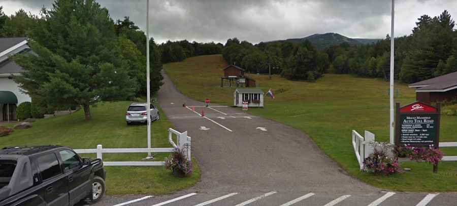
The toll road to the summit is paved only for the first ¼ mile; the rest is entirely unpaved. This road is known as the Mt. Mansfield Auto Toll Road.
How Long is the Road to Mount Mansfield?
The road is quite steep. Starting from VT-108, the ascent is 7.56km (4.7 miles) long, with 7 hairpin turns. Over this distance, the elevation gain is 820 meters, with an average gradient of 10.84%. The road ends at a parking area near Mt. Mansfield's Visitor Center.
How Challenging is the Road to Mount Mansfield?
The road is barely wide enough for two vehicles. It has sharp, steep curves and is not recommended for novice drivers or for vehicles longer than a pickup truck. It’s advised to drive down in low gear to avoid overworking your brakes. Vehicles should be in good condition, and brakes, radiators, and transmissions should be checked beforehand. There are gullies along certain points, and descending vehicles have the right of way, so be prepared to pull over for oncoming traffic. Although narrow, the drive is not particularly frightening.
Can I Drive My Vehicle on the Road to Mount Mansfield?
Trailers, RVs, campers, vans converted to RVs, mopeds, scooters, motorcycles, and bicycles are not permitted on the road.
Is the Road to Mount Mansfield Open in Winter?
The road is open only from June to October due to snow, with operating hours from 9 am to 4 pm. Keep in mind, weather at the summit can vary significantly from the base.