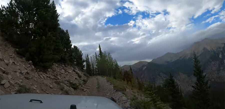
A narrow old mining road to Boulder Mountain in Chaffee County
Boulder Mountain is a high mountain peak at an elevation of 4,035m (13,238ft) above sea level, located in Chaffee County, in the US state of Colorado. Full-sized vehicles might have problems. It’s one of the highest roads in Colorado.
Is the road to Boulder Mountain unpaved?
The road to the summit is totally unpaved. It’s an old mining road called Forest Service Road 279 (Boulder Mountain Road).
How challenging is the road to Boulder Mountain?
The road is very narrow and follows a narrow roadbed as it switchbacks up the side of the mountain. Many parts of the trail are too narrow for two vehicles to pass at the same time. The trail is extremely narrow and can be dangerous, if not impossible, if you meet someone coming in the opposite direction. The road is rough and potentially dangerous to drive.
How long is the road to Boulder Mountain?
The road through the summit is 9.8 km (6.08 miles) long, starting from Alpine. Over this distance, the elevation gain is 1,020 m, and the average gradient is 10.40%.
Is the road to Boulder Mountain open in winter?
Set high in the Sawatch Mountains, the road is totally impassable in winter.
Is the road to Boulder Mountain worth the drive?
At the end of the road, you can see the remains of an abandoned mine. The drive offers amazing views of Mt. Antero and Mt. Princeton.
Pic&video: Endless Adventures