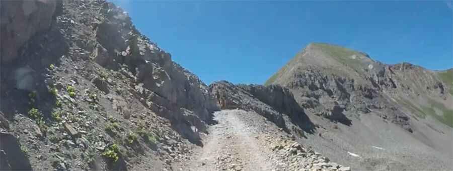
A truly epic road to Kennebec Pass in Colorado
Kennebec Pass is a high mountain pass at an elevation of 3,561m (11,683ft) above sea level, located in La Plata County, in the U.S. state of Colorado. 4WD with good clearance is needed for the last section of the road.

Where is Kennebec Pass?
The pass is located to the northwest of Durango, in the southwestern part of Colorado. A steep, dangerous road near the summit climbs up to Snowstorm Peak.
Can you drive to Kennebec Pass in CO?
The road to the summit is completely unpaved and is called County Road 124. It’s a hardscrabble road cleaved in the 1800s and originally used by prospectors. This ride is truly epic with a few tight turns.
How long is Kennebec Pass in CO?
Starting at US-160, near the town of Hesperus, the road is 22.69km (14.1 miles) long.
How challenging is the road to Kennebec Pass?
The winding road is pretty steep, with a maximum gradient of 15% through some of the ramps. Only about the last two miles require 4WD. Near the summit, the road has very steep drop-offs, requiring experienced drivers to skillfully navigate the high-elevation route. There is little traffic on this ride, so carry bike tools, a tire repair kit, and a pump.
Is Kennebec Pass open?
Set high in the La Plata Range within the San Juan National Forest, the road is usually impassable from late spring through late fall, depending on snow.
Is the road to Kennebec Pass in CO scenic?
The views are amazing and worth the drive. About a mile before the pass, there is an obvious parking area. The drive offers incredible panoramas of the surrounding mountains. Along the way, you can see old mining equipment and abandoned structures. The summit offers breathtaking views of the Rocky Mountain scenery.
Pic: jeffraich