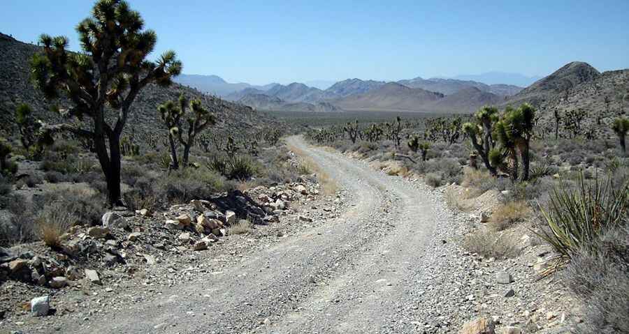
Alamo Road in NV: if you get stuck during summer you die
Alamo Road is a very remote drive in Clark County, in the U.S. state of Nevada. Passenger vehicles aren't recommended. Conditions are hazardous.

How long is Alamo Road?
Tucked away in the Desert National Wildlife Refuge, the trail is 70 miles (113 km) long, running from Corn Creek Field Station (in the south) with the town of Alamo (in the north). The road is totally unpaved and tops out at Sheep Pass, at 1.536m (5,039ft) above the sea level. The road is open year round. Alamo Road runs along the west side of the Sheep Range and comes out on HWY 93 just south of Alamo. A high clearance vehicle is recommended when adventuring out here, though a 2WD can get you around to most places on Alamo Road and Mormon Road. Just use common sense when off-roading. Sandy in sections, the possibility for water crossing and mud. One section becomes almost impassible during the wet season. Advised not to do this road in bad weather, as you can find yourself in a flash flood.
How long does it take to drive Alamo Road?
Located to the north of Las Vegas, plan about 2 hours to complete the drive. This road is also called Old Corn Creek Road. Close in, the road is graded occasionally, but out past Hidden Forest Road the road has rocky spots and washouts that tend to sneak up in a way that could break an axle. The speed limit is 25 mph, and sticking to the speed limit will help prevent broken axles on unseen rills across the road. This bumpy dirt road runs north along the west side of the Sheep Range to Desert Dry Lake.
Is Alamo Road remote?
The ride is rather remote, so you need to be prepared. In case of a breakdown, there is very little in the way of passing traffic or inhabitants around. It runs out into wild and remote country. There are no services (no fuel) or developments of any kind. Cell phones work along the south end of the road, but don't count on calling from farther out. It's very likely that no one goes out past Sheep Pass for days at a time, and it could be as much as a 50 miles hike back to Corn Creek if something bad were to happen. Bring water and food, a spare tire, a shovel, tools, a tow rope, bailing wire, and anything else needed to survive a night or two stuck in the desert. This trail was developed by pioneers as travel routes at the turn of the 20th century. While the Dry Lake portion of the road is often impassable and closed due to hazardous conditions, there are many stops along the way that make it an excellent trip. “Given the extreme heat and the slim chances of being found quickly, anyone whose vehicle gets stuck in that area is putting their life at risk,” said Christy Smith, Project Leader for the Desert National Wildlife Refuge Complex. “We cannot overstate the hazards drivers will encounter along this route.”