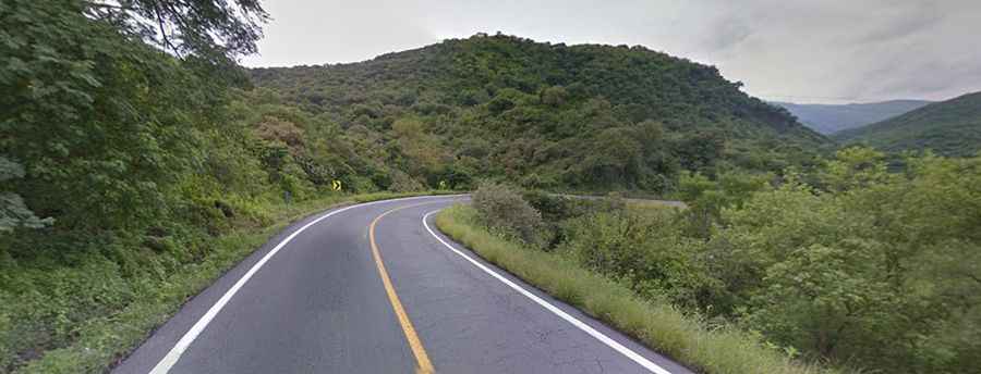
Travelling through the curvy Plan de Barrancas in Sierra Madre
Plan de Barrancas roads (Mexico 15 and Mexico 15D, autopista Guadalajara-Tepic) link Guadalajara to the Pacific Ocean, mainly the cities of Tepic and the resort city of Puerto Vallarta.
Are Plan de Barrancas roads paved?
Mexico 15D and Mexico 15 libre are windy and narrow paved roads, with sharp curves, some in 180°, trough the rugged mountains of Sierra Madre. Highest elevation is near La venta el Astillero at 1.660 m above sea level to lower 930 masl in Tepic.
Why are Plan de Barrancas roads dangerous?
Plan de Barrancas segment is the deadliest in the route between Guadalajara-Tepic, mainly because users don’t know how to take curves properly or simply because of speeding and higher traffic volumes, as well this is the only “fastest” road route to Puerto Vallarta.
Are Plan de Barrancas roads worth the drive?
It has great views of the canyons and mountains, with a lush vegetation of tropical rainforest. Same route offers another great views of agaves (tequila plants), mountains and valleys, one of the most impressive is the remnant of lava from Ceboruco volcano, next to highway, this volcano made eruption in the 1940’s and different biomes, such rainforest, tropical plants, oaks and some pine forest.
Road suggested by: Eblem Torres