Ruta Tepehuana is a windy and narrow road with incredible views
Ruta Tepehuana (Camino a Huzamota) is located in Durango, Mexico. This road is known for being windy, narrow, and potentially hazardous, offering views of the Sierra Madre mountains and canyons. Elevations range from 2,700 meters above sea level to the canyon's bottom at 500-0 meters.
When was Ruta Tepehuana built?
The road was inaugurated in 2014 and became a fully operational paved road by 2016. It passes through five different biomes: painted desert, cactus desert, pine forest, oak forest, and tropical jungle.
How long is Ruta Tepehuana?
Spanning 288 km (178 miles), this steep road connects Durango city with the area near Jesus María in Nayarit.
How’s driving Ruta Tepehuana?
The road's first section includes a mountain pass and a canyon pass. Starting at 1,430 meters above sea level in Mezquital, Durango, it rises to 2,490 meters, offering views of the Mezquital valley and canyons. It then descends to Temoaya town at 1,300 meters and further to the Mezquital River at 1,090 meters. After crossing the river, the road climbs to 2,540 meters, with views of the Mezquital canyon, pine forests, cactus deserts, and oak forests.
The next segment descends to Huazamota, starting from Llano Grande at 2,300 meters and moving through a pine forest stretch up to 2,700 meters. Owned by the indigenous Tepehuan people, the road then descends from Mesa de las Milpas community at 2,600 meters to 600 meters in San Antonio de Padua over less than 35 kilometers. This descent passes through pine and oak forests, tropical forests, and cactus-laden canyon areas.
After San Juan Peyotan, there is a junction where Mexico 23 meets Mexico 44, offering views of the Sierra Madre Mountains. In either direction, the road offers breathtaking views of the Sierra Madre Mountains, either towards Camino a Canoas or Mesa del Nayar.
Is Ruta Tepehuana dangerous?
- Seclusion: You might see only one or two vehicles per hour, but many pedestrians, mainly indigenous people.
- Drug Trafficking: The area is known for drug trafficking and has a high risk of kidnappings or extortion.
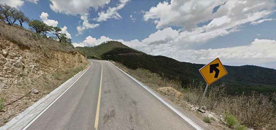
- Road Conditions: The road features sharp turns and challenging curves. Speeds rarely exceed 40 mph and are often closer to 30 mph. Some areas lack signals and road paint, complicating night driving.
- Potholes and Falling Rocks: Potholes are common, especially near mountain cuts, and falling rocks are a hazard.
- Pedestrians and Guardrails: Pedestrians sometimes walk in the middle of the road. Some areas lack guardrails beside canyons.
- Night Driving: Driving at night is not recommended due to sharp turns and frequent fog.
- Brake Overheating: The route has steep and extended downhill sections, which can overheat brakes. Engine braking is essential to prevent brake failure. The elevation changes by a combined total of 4,000 meters.
- Cellphone Coverage: Sparse throughout most of the route.
Road suggested by: Eblem Torres