Driving the remote Northern Ontario Resource Trail
Northern Ontario Resource Trail (NORD) is a very scenic yet challenging and remote road located in the Canadian province of Ontario.
When was Northern Ontario Resource Trail built?
Built in 1966 it links several winter roads and ice roads. From 1966 to 1983 it was known as Tertiary Highway 808.
Is Northern Ontario Resource Trail (NORD) paved?
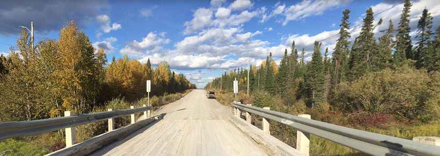
The road is mostly unpaved. The first 3 km (south) are paved, but the rest are gravel. The road is well-maintained year-round.
Can I drive my vehicle on the Northern Ontario Resource Trail (NORD)?
Although the road can be driven by high clearance two-wheel drive vehicles, there are many sections that will require a slow speed due to the nature of the road and the many moose that frequent the area. So, a 4x4 vehicle is recommended.
How long is Northern Ontario Resource Trail (NORD)?
The road is 238km (148 miles) long running south-north from Pickle Lake to the northern shore of Windigo Lake, in the northernmost community in the province which has year-round highway access.
How remote is the Northern Ontario Resource Trail?
The area is really remote: extremely lightly travelled, it can be days before the next vehicle comes along. It is recommended to fill up on gasoline and supplies, and check weather conditions before travelling down this road, since there are no gas stations or any other services anywhere along the route north of Pickle Lake. And remember gas stations are not open 24/7. A spare tire is also a good idea, as it may be several hours (at least) for assistance to arrive. Cellular phones are useless in this area, since there are no nearby cell phone relay towers in the wilderness.
How to drive the Northern Ontario Resource Trail?
Caution must be used while driving as well, as there are some steep grades on the route. Although the speed limit is 80 km/h (50 mph), there are many sections where such a speed can not be maintained. When driving, take care with the moose. More than 700 of the animals are struck each year in the province.
Pic: Frank Hochstenbach