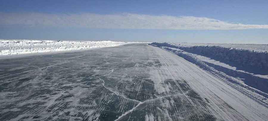
Tuktoyaktuk Winter Road closed permanently on April 2017
Tuktoyaktuk Winter Road was an ice road in the Northwest Territories of Canada, running across the frozen Mackenzie River and the Arctic Ocean. It was one of the world's northernmost roads.

Where did the Tuktoyaktuk Winter Road start and end?
The road was part of the Dempster Highway, the only public road to cross the Arctic Circle. Located in the Northwest Territories, the ice road was 177km (109 miles) long, running from Inuvik to Tuktoyaktuk. During the summer, Tuktoyaktuk was only accessible by boat and plane, but every winter, as soon as the weather was cold enough, crews started building the ice road. The ice road was featured in the reality television series Ice Road Truckers in 2008.
How was the Tuktoyaktuk Winter Road?
The ice road was in service only during the three coldest winter months (December through March) when the water of the Mackenzie River Delta freezes, tracing a natural road over the length of the river and parts of the Arctic Ocean. During summer, the road melted and formed a flowing river. During this season, the village of Tuktoyaktuk (commonly called "Tuk") could be reached only by plane or boat. The airport has a gravel runway suitable for jets such as Boeing 737s with special equipment to deal with gravel being thrown up. Tuktoyaktuk receives few visitors. The village in the far north of Canada has no restaurant or hotel. The world’s longest ice road serviced gas hydrate fields and exploration facilities at Mallik, Aput, and Langley, along with the ice-locked barges Wurmlinger and Arctic Star, which act as bases of operations for ice road crews and exploration personnel. In addition, the road was a key supply line for Tuktoyaktuk and the hamlet of Aklavik. Thousands of rigs threaded their way along the frozen highway each year, hauling fuel, cement, equipment, and supplies to four diamond mines and several exploration sites otherwise accessible only by air. The rest of the Dempster Highway is on land and can be driven on through the summer. Accidents were rare on the road, due to the light traffic. The ice that made up the road was about 8 feet thick and was littered from place to place with cracks and ridges, making it one of the most dangerous stretches of road. There were times when you felt like you were driving on glassy marble: in Inuvik, daytime highs are between -7°C and -17°C, dipping at night.
Is the Tuktoyaktuk Winter Road open?
The road closed on April 29, 2017, and was replaced by the Inuvik-Tuktoyaktuk Highway, the first all-weather road to Canada's Arctic Coast. Construction of the new road took four years and was opened to the public by fall of 2017, after which the infamous Tuktoyaktuk Winter Road was permanently closed.
Pic: By Ian Mackenzie - originally posted to Flickr as The ice highwayUploaded using F2ComButton, CC BY 2.0, https://commons.wikimedia.org/w/index.php?curid=8463579