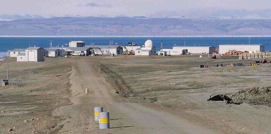
Eureka Highway is a remote drive in the northernmost territory of Canada
Eureka Highway is an all weather highway located in Nunavut, the largest, northernmost and newest territory of Canada.

How long is Eureka Highway?
Centrally located on Ellesmere Island, the road is totally unpaved. It’s 20 km (12 mi) long and runs from Eureka Weather Station to CFB Eureka and the Eureka Airport. Eureka is a small research base on Fosheim Peninsula, Ellesmere Island, Qikiqtaaluk Region, in the Canadian territory of Nunavut, and it's the second-northernmost permanent research community in the world. The station was established in 1947.
Is Eureka Highway open?
While the precipitation at Eureka is so low it is classed as a desert, the snow that does fall stays around for the whole winter because of the low temperatures. Keeping the road open is an on-going activity. Between mid-October and late February, the area is plunged into total darkness.
Pic: By Ansgar Walk - photo taken by Ansgar Walk, CC BY-SA 2.5, https://commons.wikimedia.org/w/index.php?curid=606190