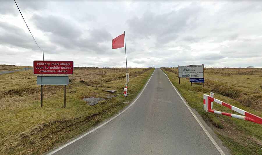
Driving on the military road from Tirabad to Llywel you can hear gunfire
Tirabad-Llywel is a paved military road located in southern Powys county, in Wales. Check there isn't any military training on first.

Is the road from Tirabad to Llywel paved?
Tucked away on the edge of the Brecon Beacons National Park, one of three national parks of the country, this superb road is totally paved and links the villages of Tirabad and Llywel. It doesn’t seem to have a name, although on a map it crosses Mynydd Eppynt and Mynydd Bwlch-Yr-Groes, a small range of hills to the north of the Brecon Beacons. The surface is in very good condition, amazingly smooth, probably because it’s looked after by the army. It is highly recommended for any type of vehicle.
Is the military road from Tirabad to Llywel open?
It is a narrow road built by the Ministry of Defence that runs through Sennybridge army training area, and it is open to the public, unless otherwise stated for Army exercises. The area is used for 350 days per year for many different aspects of military training, such as artillery testing, rifle ranges, survival situations and war zone simulation. Each time you drive this road, you can hear gunfire and see soldiers hiding in bushes. There can be quite a lot of military traffic on it.
How long is the military road from Tirabad to Llywel?
The road is 13.51km (8.4 miles long) running north-south from Tirabad to Llywel. It has numerous blind turns and summits, with passing areas. The road has stunning views, and is quite exposed to the weather, reaching 442m (1,450ft) above the sea level. The southern section of the road has a 1 in 7 hill. Along the way there is evidence of the communities that lives here for generations and made a living from sheep farming in this exposed and isolated place.
Road suggested by Andy Cox