What are the most spectacular roads in Wales?
Located in the southwestern part of Great Britain, Wales is a country with countless interesting roads. Some of them are defiant mountain roads, others face challenging gradients, and the list is completed with scenic drives. Covering an area of 20,779 square kilometers, the country must be on any driver’s list.
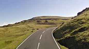
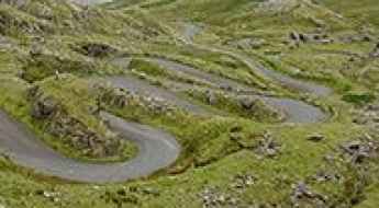
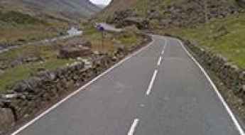
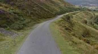
You can’t miss the breathtaking Black Mountain Road, the Top Gear road of Wales. Located in the county of Carmarthenshire, it is a famous route that twists, dips, and climbs. It's worth mentioning the inhumane Devil’s Staircase, with 21% ramps. It is a series of hairpin turns reaching a maximum gradient of 20.1%, running through the Cambrian Mountains. Or the defiant Shell Island Causeway, which is covered by seawater at high tide. Located in Gwynedd, twice a day the tidal causeway to the island disappears with the tides, leaving the area underwater. Do not proceed when the road is flooded. It’s one of the periodically flooded roads in the world.
For brave drivers, Ffordd Pen Llech is the steepest road in the UK (37.45%), located in the medieval castle town of Harlech.
The breathtaking Black Mountain Road is the Top Gear road of Wales
Located in the county of Carmarthenshire in Wales, Black Mountain Road is a famous route that twists, dips, and climbs. It has unrivaled views beyond its hairpin turns, and you’ll want to drive it again and again.
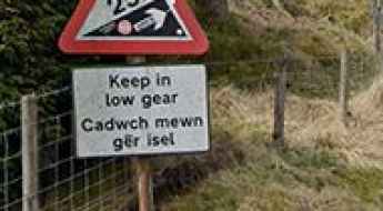
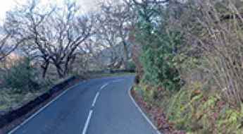
The inhumane Devil’s Staircase in Wales with 21% ramps
The inhumane Devil’s Staircase in Wales with 21% ramps. The Devil’s Staircase is a series of hairpin turns, reaching a maximum gradient of 20.1%, running through the Cambrian Mountains in Wales. It is an old drover's track stretching for about 20 miles between the small hamlet of Abergwesyn and the town of Tregaron.
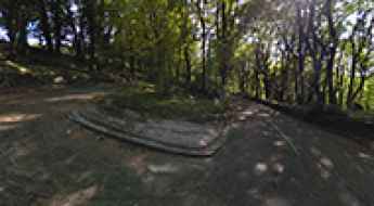
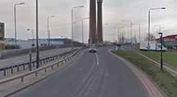
How to get to Stwlan Dam in Wales?
Llyn Stwlan is a mountain reservoir at an elevation of 512m (1,679ft) above sea level, located in the county of Gwynedd, in Wales.
Driving the 5 most scenic roads of Wales
The best driving routes in Wales, including journeys through the Brecon Beacons and Snowdonia.
Driving the brutal road to Hellfire Pass in Wales
Bwlch y Groes (Pass of the Cross) is a mountain pass at an elevation of 545m (1,788ft) above sea level, located in the county of Gwynedd, in Wales. It’s one of the highest roads in the country.
What are the highest roads in Wales?
Famed for its strikingly rugged landscape, Wales is a country that forms the western side of Great Britain and is an integral part of the United Kingdom. Bordered by England to the east, the Irish Sea, and the Bristol Channel, its geography is defined by strong contrasts. The nation is powerfully mountainous, dominated by two major geological regions: the Cambrian Mountains across the center and north, and the Brecon Beacons in the south.
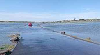
Shell Island Causeway is covered by sea water at high tide
Located in Gwynedd, Wales, Shell Island is a peninsula and the largest campsite in the UK. Twice a day, the tidal causeway to the island disappears with the tides, leaving the area underwater. The road is prone to tidal flooding. Do not proceed when the road is flooded. It’s one of the periodically flooded roads around the world.
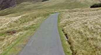
Ffordd Pen Llech is the steepest road in the UK (37.45%)
Located in the medieval castle town of Harlech, in the North Wales county of Gwynedd, Ffordd Pen Llech is one of the steepest paved roads in the world, with a maximum gradient of 37.45%.
An Unforgettable Drive to Llanberis Pass in Snowdonia
Llanberis Pass is a mountain pass at an elevation of 360m (1,180ft) above sea level, located in Snowdonia, Gwynedd, in Wales.
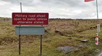
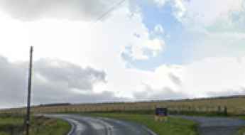
Driving on the military road from Tirabad to Llywel you can hear gunfire
Tirabad-Llywel is a paved military road located in southern Powys county, in Wales. Check there isn't any military training on first.
Driving the narrow road to Gospel Pass in Wales
Bwlch yr Efengyl (Gospel Pass) is a mountain pass at an elevation of 551m (1,807ft) above sea level, located in southeast Wales, near the English-Welsh border. It’s one of the highest roads of the country.
The B4560 road in Wales is one of the most scenic drives of Europe
Located within the Brecon Beacons National Park, in the county of Powys, in Wales, the B4560 (Llangynidr Road) is said to be one of the most scenic drives in Europe.
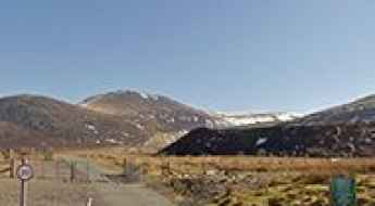
Marchlyn Mawr Dam Road: A Scenic Journey Through Wales' Heartland
Marchlyn Mawr Dam is a natural lake dammed to form a reservoir at an elevation of 643m (2,109ft) above sea level, located in Gwynedd county, in Wales. It’s one of the highest roads of the country.
A brutally steep road to Bwlch Pen Barras in Wales
Bwlch Pen Barras is a mountain pass at an elevation of 360m (1,181ft) above sea level, located in Denbighshire county, in Wales. It includes climbing 25% at various points.
How to Travel the A44: A Scenic Road from Rhayader to Aberystwyth
Part of the A44, one of the main roads in mid-Wales, the stretch from Rhayader to Aberystwyth is a highly scenic drive on the west coast of the country.
A very steep road (15%) to Ffynnon Llugwy
Ffynnon Llugwy is a natural lake at an elevation of 554m (1,817ft) above sea level, located in Snowdonia, in Wales. It’s one of the highest roads in the country.
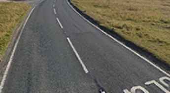
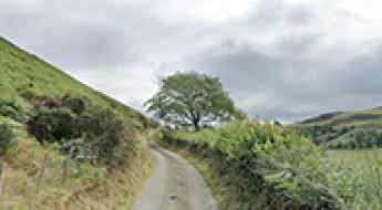
A steep paved road to Bwlch y Cloddiau in Mid Wales
Bwlch y Cloddiau is a mountain pass at an elevation of 533m (1,748ft) above sea level, located in Powys, in Mid Wales. It’s one of the highest roads in the country.
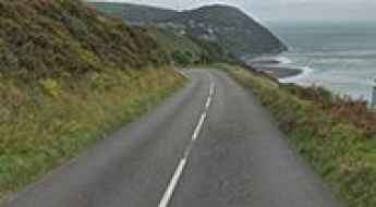
Driving the scenic yet challenging A496 road in Snowdonia
A496 is a very scenic yet challenging road that twists and turns through diverse landscapes in Snowdonia, Wales.
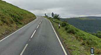
Horseshoe Pass: Wales' Scenic Gem and the Drive of a Lifetime
Bwlch yr Oernant ("Pass of the Cold Stream") is a mountain pass at an elevation of 419m (1,374ft) above the sea level, located in the county of Denbighshire in Wales.
Driving the scenic Carmarthenshire's Black Mountain Pass
Black Mountain Pass (Bwlch Mynydd Du) is a mountain pass at an elevation of 495m (1,624ft) above the sea level located in the county of Carmarthenshire in Wales.
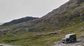
How To Travel The Miner’s Track in Snowdonia
Miner’s Track is the name of a very challenging drive located in Snowdonia, Gwynedd, in north-west Wales. The road is closed to private vehicles.
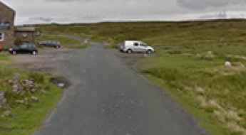
Driving to Sportsmans Arms, the highest pub of Wales
Located in Conwy County Borough of Wales, the Sportsmans Arms (Tafarn yr Heliwr) is said to be the highest pub of Wales.
5 Breathtaking Road Trips Across the UK
The United Kingdom offers a diverse tapestry of driving landscapes, from the technical mountain passes of the North to the disappearing coastal roads of the South West. For the road enthusiast, these iconic routes provide more than just scenery; they offer a masterclass in British road engineering and natural beauty. Before heading out, ensure your vehicle is expedition-ready, with particular focus on tire integrity and braking systems for the steep descents ahead.
10 Most Dangerous Roads to Drive on in the UK
While many of us enjoy a road trip, are there some roads we should be more aware of than others? This article will look at the 10 most dangerous roads to drive on in the UK, from high-altitude mountain passes to treacherous rural arteries.
Tackling the 12%: The Dramatic Steepness of The Shelf Mountain Pass in Wales
The Shelf is a mountain pass at 348m (1,141ft) above the sea level, located in Denbighshire county, in Wales.
Driving the Britain's bendiest roads
In a landscape where classic alpine hairpins are a rarity, Great Britain offers a different kind of challenge: high-frequency, undulating bends that demand constant steering input and precise load management. Some of these sectors exert lateral forces comparable to a professional racetrack. Navigating these ten roads requires more than just speed; it requires a deep understanding of vehicle dynamics and apex clipping in high-consequence environments.
Where are the highest pubs in the UK? A guide to the ultimate road trip stops
If you're scouting for pubs that combine history, great food, and spectacular views, consider heading to the UK's highest inns. From the captivating moors of North Wales to the scenic dales of North Yorkshire, these pubs offer more than just a pint.
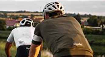
Urban Hazards: The 8 Most Dangerous Zones for Cyclists in the UK
Cycling in the UK has seen a significant surge, with over 7.5 million regular riders. However, the intersection of historic urban layouts and heavy motorized traffic creates significant "blackspots." While cycling is an excellent mode of transport, understanding the technical hazards of major city arteries is crucial for safety. Here are eight of the most notorious areas for cycling incidents in the United Kingdom.
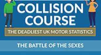
The deadliest UK Road Accident Statistics
We looked at the latest DVLA and UK Gov statistics to find the most dangerous situations on UK roads. From age and gender to left vs right turns, we’ve statistical found the most common situations for road accidents. For instance- statistically, in the UK, you are most likely to have an accident as a 20-29 female, driving a car to work, when making a right turn on an urban road at a T junction.
Motorcycle Fatality Hotspots: Analyzing the UK’s Highest-Risk Arteries
Recent analysis of government crash data reveals a stark contrast in motorcycle safety across the United Kingdom. While urban congestion in London accounts for the highest volume of incidents, rural A-roads in regions like Wales present a significantly higher risk of fatal outcomes. For riders, understanding these patterns is the first step toward effective risk management on the road.